Michael Blakstad is the 'publisher' of the East Meon History Group. His career was spent initially in broadcasting, in BBC TV, and both Yorkshire TV and Television South, and as in independent producer. His company Workhouse was a pioneer of interactive media. He lives in East Meon and manages the History website.
All Saints church was described by Nicholas Pevsner as ‘one of the most thrilling churches in Hampshire’. Built in stages between the 11th and the 14th centuries, its size and beauty reflect the fact that East Meon then comprised two manors which reached to the Sussex border and beyond. This section includes a history of the church over the centuries and descriptions of some of its outstanding features, including the Tournai font.
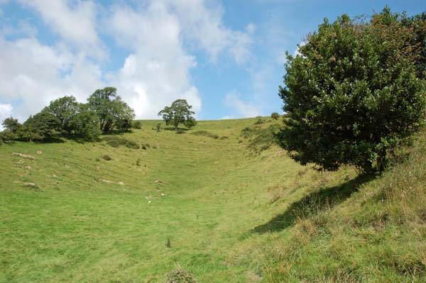
Vineyard Hole, the reputed site of a medieval vineyard.
Between The Court House and the Park is a fold in the hillside known today at Vineyard Hole, and it is assumed that grapes were grown here for the production of wine. Entries in early Pipe Rolls confirm that the Manor did produce wine in the 13thand 14thcenturies:
1207–8 ‘4 tuns of wine – £4.2s.0d’
1305-6 Pipe Roll: 3 men …. paid to help the gardener dig in the garden for planting vines there … weeding vines sometimes – 12d.
(A tun is equivalent to 252 gallons.) This would not have been for the exclusive use of the Bishop and his guests, like the fresh fish from Fishponds, but for consumption by the famuli of the manor and for sale like the rest of the farm produce. The dates of the entries, 1207 – 1306, lie within the protracted warm period in Hampshire, which ended in 1315, and no wine production was recorded after this.
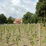
Vineyard at Court Farm planted 2006
Today’s place names are modern inventions, and ‘Vineyard Hole’ a 19thcentury fabrication; in the Tithe Apportionment records of 1852, the name is ‘Shepherd’s Hole’, but in the Ordnance Survey map of 1869 ‘Vineyard Hole’ appears for the first time.
The reference in 1305 to the garden suggests that the wine was grown within the curtilage of The Court House. In 2006, the present owners of The Court House planted 1,400 pinot noir and chardonnay vines in the ‘Berrygarden’, which have since produced a notable sparkling wine.
by Charles Sprinks (Church Warden, St John’s Langrish)
East Meon’s Pest House was situated in Stroud, built in 1703.
Church Wardens are asked many strange questions:
“Where is granny’s unmarked grave? I know it is near a clump of snowdrops”.
“Why isn’t Langrish School in Langrish?” – A frustrated delivery driver.
“How much further is Arundel, we are late?” – A car heading towards Winchester
Perhaps the strangest question by someone tracing their ancestors, “Where is the Langrish Pest House – my great grandparents were born near it?” This was baffling. I had heard of Pest Houses, but not in Langrish. There is a Pest House still standing next to the churchyard in Odiham, together with the whipping post and stocks. Some years ago, new houses were built in Pest House Lane at Whitchurch near Basingstoke, but when they were sold the owners petitioned for the name to be changed to something really original such as ‘New Road’.
In 1625 there was an outbreak of the plague in East Meon and Langrish. Two hundred and thirty-five people died in Petersfield in 1666 within eight months and contact with adjacent villages was virtually suspended. Following the plagues, an outbreak of smallpox be- came the greatest scourge. As a result, Pestilence Houses were constructed on the outskirts of most towns and villages where families with contagious or infec- tious diseases were isolated, with food left at an agreed spot for collection.
Pest Houses were built for obvious reasons on the very outskirts of a parish. West Meon’s Pest House was constructed just west of the Meon Hut crossroads. on the periphery of the then large, combined parish of East Meon, on the unenclosed wasteland at ‘The Stroud’.
The building, now Mount Pleasant Farm, which was originally built to house the plague victims of East Meon parish.
The purpose-built Pest House was constructed in 1703 on land north of what isnow Ramsdean Road, nearly opposite Langrish School. The building consisted of four rooms, two up and two down, of brick and stone construction under a thatched roof, each room intended to house an infected family in isolation from the community. The Pest House continued in this capacity, or as a poor house until 1834, when the Petersfield Union Workhouse was built in Love Lane.
The original building which still bears an engraved plaque which reads “East Meon Pest House 1703”, has been considerably enlarged and improved and is now known as Mount Pleasant Farm, home of Mr and Mrs Wright. “Mount Pleasant” and “Love Lane” – our ancestors certainly had a strange sense of humour!
Why is East Meon and Langrish Pest House situated in Stroud? The three villages were all one, Langrish becoming a separate parish in 1870, Stroud further separated in 1932.
‘A moment on the lips, a lifetime on the hips’. They used to say that about cream. The same could be said of the photographs and documents so generously contributed by villagers on the Open Day in September, and by visitors with East Meon connections. Members of the Group scanned the material and indexed it that afternoon …. now it is being archived, which is taking a lot longer.
Accessioning collections on Open Day.
When you think of archives, you probably think of shelves with files and boxes of paper. Well, we have 20 boxes of paperwork, stored in my study and catalogued in what I optimistically call the Library. But that is a small proportion of what we have collected, and the good news is that you don’t have to knock on any doors to get to the vast majority of our records. This archive is digital, and available online. Take a look at www.eastmeonhistory.org.uk. You will see how far we have got. Still very much work in progress, but then, it will never be complete!
The aim is to make available to anyone, anywhere, the records of East Meon. The challenge is to make it easy to find what you are looking for. The grant made by the Heritage Lottery Fund enabled us to commission an agency to develop the digital archive for us. CommunitySites specialises in this kind of work – it works with a number of villages who have made their archives available online. I hope I am not exaggerating when I say that the East Meon archive has stretched them even further than previous sites. I hope you will agree that it’s visually attractive, with pictures heading every section and page. We are blessed (thanks to your contributions) with some wonderful old photographs. At the bottom of some pages is an invitation to download documents – mostly PDFs of articles and reports which have been scanned. Each item is catalogued, and you can see where the full document or larger images can be inspected, either online, in a Dropbox folder, or in the Library. You can search by key words, by dates, or by trawling the site.
Bear in mind that this is work-in-progress. Do, please, let me know of any errors, or of information you can supply which isn’t there – lots of the content is either unidentified or skimpy. If you have any similar material which you’d be happy for us to enter into the archive, do let me know … I can scan your photographs or papers on the spot, without them having to leave your sight.
Huge thanks to those who did bring material. Hopefully, researchers in years to come will find this a useful resource, and villagers will take pride in East Meon’s fantastic history.
All residents of East Meon are invited to an Open Day in the Village Hall on Saturday September 28th, 2.00 – 5.00pm. You won’t be asked to spend any money!
Do you have old photographs of family or village events? Newspaper clippings from before 1975? Letters, rent books, or your own memories of East Meon as it was forty or more years ago? Do dig them out and bring them along.
You may just want to know more about the village in which you live. You, too, will be welcome. East Meon has a great history – come and be part of it! The Heritage Lottery Fund is supporting this Open Day, which is designed to involve as many people as possible in the history of our village.
Thanks to the HLF grant, we are offering free refreshments , tea or soft drinks and cake (at least, as long as supplies last….) If you want to know more about the heritage of the village, we shall be mounting a Timeline of village history, and an exhibition of Historic Houses of East Meon. There will also be guided walks around the village, taking you round these buildings. We hope to persuade young children to come in historic costumes (prizes will be offered!), and older ones to follow history trails (more prizes …)
The History Group is also determined to record the ‘Living History’ of East Meon. Those of you who have family photographs, old letters or newspaper clippings, or any other memorabilia of life in East Meon pre-1975 are cordially invited to bring them along. We shall make digital copies of these and store them in the village archive. Those who can remember life in the village before 1975 will be invited to take part in audio interviews – we shall explain what is involved at the Open Day and, if you are willing, arrange to record an interview on a later date.
We also need help in identifying people and events shown in old photographs – like the ones on this page. We hope that some of you will want to learn more about life in East Meon in earlier times, possibly researching your family’s history, or the origins of the house you live in. Members of the History Group will help you in this research. We are discussing with the village school activities through which the children can become involved as well.
The Open Day is the tip of an iceberg which the Lottery grant is helping us construct. Under the surface will be an archive which will help anyone researching the history of the village and those connected with it, most of which will be available through www.eastmeonhistory.net. The grant is enabling us to purchase recording equipment, display screens and storage for old documents. We shall be able to print a pocket-sized edition of the Guide to Historic Buildings. The grant is a tremendous boost to the activities of the History Group, and we want as many residents as possible to be able to enjoy its benefits. Please come on September 28th!
by Peter Head and David Hopkins, for Meon Matters November 2015
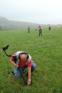
On two misty, moisty days in September 2014 the East Meon History Group embarked on its first archaeological enterprise….using geo-physical scanners and metal detectors to discover Saxon artefacts in a field “close to the village” (we all had to sign ourselves to secrecy) as part of the ‘Saxons in the Meon Valley Programme’. We found nothing Saxon. But among our finds were pieces of thick, shaped aluminium which got us all talking. Most thought they must be part of aircraft skins….but had a plane ever crashed in East Meon?
Saxon Survey September 2014 Magnetometry survey in foreground, metal detection in distance.
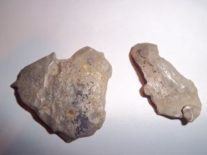
Incediary shrapnel found during geophysical survey.
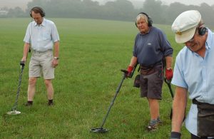
Metal detectorists, including Richard Dampney.
So began a trail of asking those who might have remembered the fighting years of the 20thcentury of their recollections. A fascinating picture began to emerge both from our archives and from interviews with people still alive.
No aeroplane crashed in East Meon. A Fairy Firefly did hit the side of Butser Hill, a Horsa Glider crashed near D-Day on Old Winchester Hill killing passengers and crew, and a German JU-88 was shot down trying to bomb West Meon Viaduct; the crew was rounded up by locals with pitchforks at Clanfield….but not in East Meon.
Many villagers remembered one night on which a number of bombs fell near the village, but they couldn’t recall when. The School Log Book provided the date: “School closed….many roads closed with unexploded bombs” … on the night of 25th-26th June 1941.
We tapped Denys Ryder’s memory; he was at Westbury House School …. “Oh yes… there were German bombersand they dropped these incendiary bombs, and the whole of Hen Wood went alight that night and it burned for two or three days. Then we were allowed out of the school, the Headmaster said ‘Not to go into Hen Wood’. Of course, boys are boys and you know exactly what happened; we all went in there. One lad picked up a complete bomb, unexploded, and started throwing it around!” The standard German incendiary bomb matched perfectly our fragments of aluminium casing.
Arthur Newbury, sympathising with the evacuee children from Portsmouth, recounted “… that little raid on East Meon. They must have mistook East Meon for Mercury. We went up Temple Lane, that’s where the Newbury family went. They dropped a bomb about fifty yards from the road in the vineyard. Another bomb was dropped just behind those five cottages in Frogmore and the other was dropped on the cricket field. It was a straight line – three bombs. You just saw these big flashes. Goodness knows how many bombs there were. Mum would say. “Tuck your little face into the bank, ducky”. The very next day there were unexploded bombs all over the place”
Jean Samways recalled: “My father passed bombs all the way down the West Meon road”. Ray Stone, the village coalman, remembers a parachute mine hanging in the trees opposite Drayton Farm and, for many years after it was detonated, a crater there, whilst Tony Simpson remembered being turned back by police at Lythe House from a fruit-picking trip to Buriton with a “Keep to the middle of the road – there are lots of incendiary bombs”.
Wilson Atkinson remembered a late summer evening raid “…a single German bomber came over and dropped three high explosives and an oil bomb aimed at the naval establishment, but missed. It set the hedge on fire”. Wilson and others saw lots of dog-fights over the village, whilst expelled shell cases dropped between Denys Ryder and a school mate, whilst they watched.
Why was East Meon bombed? As many theories as accounts! German bombers jettisoning bomb load when pursued by RAF night-fighters, Luftwaffe navigational radar ‘bent’, decoy fires on hills, pre-emptive raid on Mercury (in 1941 in early stages of construction). Perhaps we’ll never know. Was it bombed morethan once? Probably not. The casualties? Mercifully, only one pig and a few sheep.
After many hours spent at the National Archives, Kew, sifting through the numerous RAF combat reports for that night in June 1941, we could find no confirmation of RAF interception forces in contact with German aircraft over East Meon. The nearest reports for that night were filed by three pilots who took off in Beaufighters from Ford; directed by Tangmere, they engaged and shot down an enemy aircraft over the Solent using a then-classified night-detection device.
Looking at records of raids on Portsmouth, Gosport and Southampton areas, it is likely there was just one bomber, possibly a Henkel III, approaching from the South over the recently established HMS Mercury at Leydene; it flew in an arc, jettisoning its load of high explosive, incendiaries and a parachute mine over Frogmore, East Meon and Hen Wood.
1941 incendiary bombs incorporated an explosive charge in the nose cone. When a small percussion charge was detonated, the magnesium alloy shell case burst out, spreading burning Thermite and magnesium over a wide-spread area. “The heat was so intense it could burn metal” No wonder‘the fields were burning for days’.
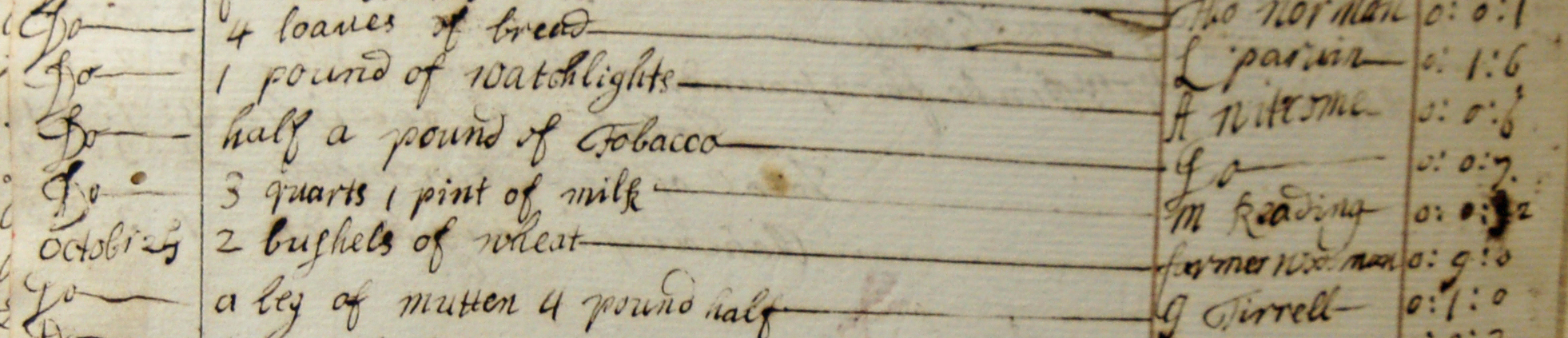
1727 accounts of Overseer of the Poor – purchases for the workhouse.
In 17thand 18thcentury England, there was a huge gap between the rich and the poor; aristocrats and large landowners such as the Bishops of Winchester, who owned the manors of East Meon, were worth millions of pounds in today’s money, while the poor were unable to feed, warm, or house themselves even if they could find work. Yet villages took very good care of their poor.
Their own poor, that is: life was much tougher for those who had been forced to migrate in search of work outside their own villages. The Privy Councils of Queen Elizabeth and the two King Jameses handed the job of local government to parish ‘vestries’, the equivalent of today’s parochial parish councils but with vastly more responsibilities. Among other duties, the vestry was required to raise the Poor Rate from those in the parish who could afford to pay it, and to appoint Overseers of the Poor who would spend the money looking after those in need. Two Overseers were appointed each year, usually well-respected yeoman farmers who received no payment for their hard work.
Those who paid the Poor Rate resented their money going to anyone who did not belong in the parish, and one of the jobs of the Overseers was to hunt out and drive away the ‘vagrant poor’. For country people, farming was the only form of employment, work was seasonal and agricultural labourers were employed on the equivalent of zero hours contracts: in bad years they would be forced to take their tools and families on the road to seek employment in other parishes. They often built shanty huts on waste land in the hope that they could remain unmolested for six months, after which they would qualify as residents of that parish. Thomas Turner, a 17thcentury Overseer of East Hoathly in Sussex wrote a vivid account of his efforts to track down and evict migrant labourers this included arranging shotgun weddings for single pregnant women, to prevent them giving birth to babies in the parish who would thereby qualify for relief.
Meanwhile, the ‘deserving poor’ were well looked after. The account books of East Meon’s Overseers record the purchase of ample food, soap, candles, beer and work tools on behalf of the poor; medical expenses were provided and most paupers were housed either with relatives or in accommodation provided by the parish. Those who could were expected to work – and the Overseers’ accounts show that most poor women did spinning, while the men were put out to do farm work. In the 1780s, Gilbert White wrote about nearby Selborne: ‘we abound with poor; many of whom are sober and industrious, live comfortably in good stone or brick cottages, which are glazed and have chambers above stairs… Besides employment from husbandry, the men work in hop gardens … and fell and bark timber … the women weed the corn’.
The Workhouse was built in the same style as Kews and Paupers cottages, its original neighbours in what is now Workhouse Lane
Selborne does not appear to have had a workhouse, while East Meon’s was built in 1727. It appears to have been a humane and caring establishment; births, marriages and deaths are recorded there, and the cost of paupers’ coffins and burials are recorded in the accounts. It wasn’t until the 1830s that poverty was labelled a social evil and a burden on society; responsibility for local government was taken away from parishes and given to town and district councils, village workhouses and overseers were abolished and East Meon’s poor were moved to the Union workhouse in Petersfield.
Old maps are fascinating, particularly when they illustrate the history of a familiar location. As part of the Gardens Open on June 25th, the History Group is exhibiting in The Court Hall the first results of our research into Farming the Valley over the centuries, starting with the Romans. Maps will feature prominently.
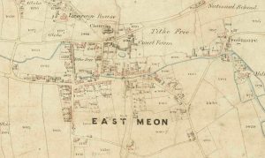
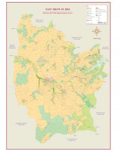
Detail of 1852 Tithe Apportionment map, showing the village of East Meon
Map of East Meon parish georeferenced for Farming the Valley
The first detailed maps of the parish of East Meon were produced in 1852, after Parliament had decreed that tithes, previously paid in kind, should be commuted to cash payments based on the value of property. A national survey was conducted and maps made which show every field, coppice, barn and common in the country. These ‘Tithe Apportionments’ have been used as the basis of an exercise to ‘georeference’ other maps, using a new computer application which overlays Ordnance Survey data, estate sales maps, archaeological and geological surveys to produce a treasure trove of illustrations of our valley, showing who owned the land at different time, who farmed it, how much rent was paid, to what use it was put and the nature of the soil.
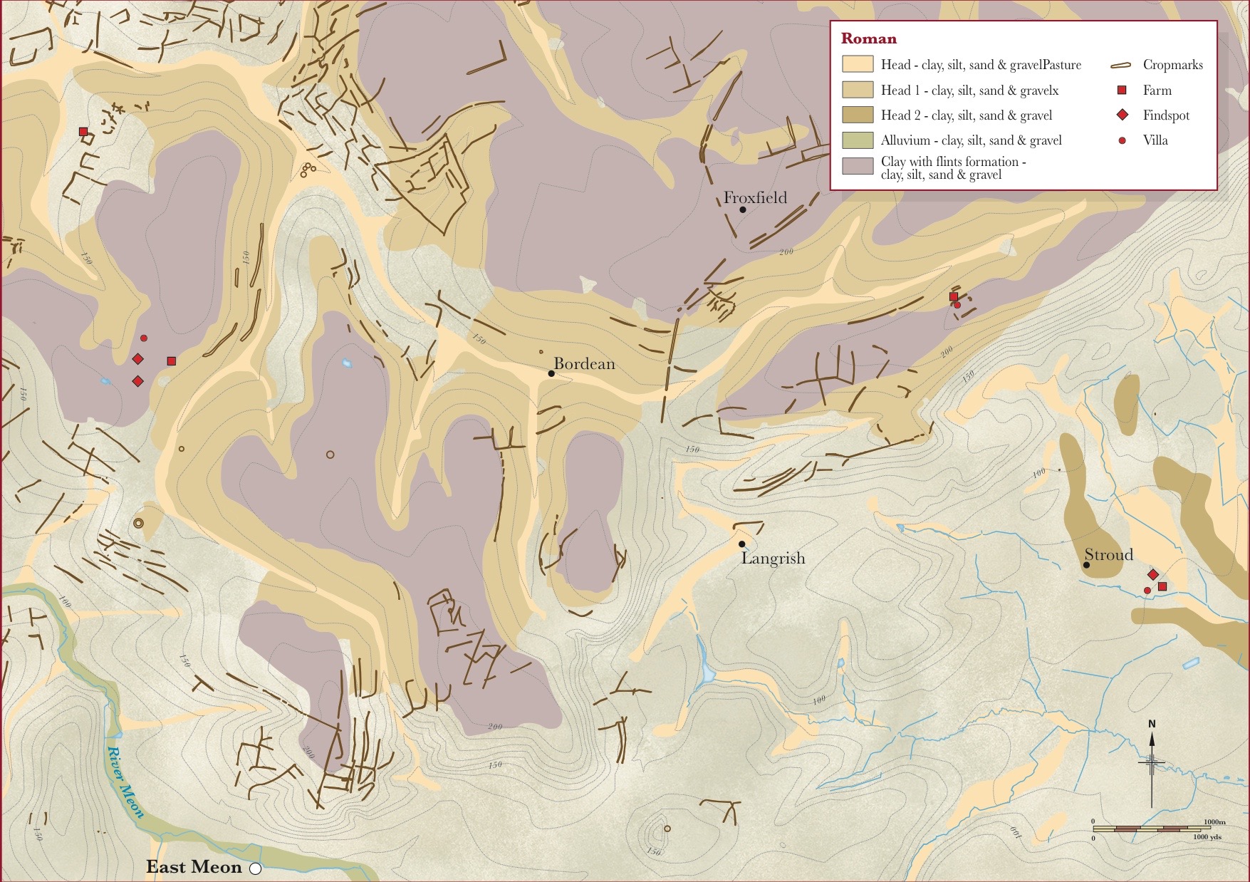
Map showing farms around East Meon in Roman times
We have used earlier documents and archaeological clues to work out how land had been used in earlier times, going back to Roman villas and medieval Open Fields, and we have shown which land was subjected to Enclosures in the 19thcentury. Robert Mocatta has mastered the geo-referencing software and meticulously logged a mass of detail from which he created overlays which illustrate the different aspects of life in our valley. We have commissioned a cartographer to convert his data into what we believe is an attractive and informative treasure trove of maps, several of which will feature in the exhibition on June 25th.
This is ‘work in progress’ and in the year ahead we shall be conducting more research, producing more maps and a larger exhibition. If any of you have old maps, particularly estate sales particulars, we would very much appreciate the opportunity to borrow and scan these so that we can use them, too, in our work.
John Christmas, father and son, make a brief but impressive appearance in the history of East Meon, and of Oxenbourne in particular. They started as yeomen, from outside the parish, but became the largest farmers in the valley and pillars of the community; after two generations, the name disappears abruptly from our records.
Hill Hampton farmhouse today
A 1790 indenture records the sale by the Bishop of Winchester the rectorial tithings of land in Oxenbourne to John Christmas of Hillhamptonfor which he was to pay £7 twice a year. He had come from Blackmore in the parish of Selborne’,and was then ‘aged about thirty nine years’ and his son was ‘John Christmas… an Infant aged about six years’. The ownership of ‘Hillhampton’ (also spelled in other ways …) was complex. As described in a previous article, the land was owned by Magdalen College, Oxford, and the farmhouse had recently been rebuilt, probably by its ‘primary’ tenant, Dr Edward Bentham of Christchurch College.
John Christmas the older lived there until his death in 1805and he bequeathed the lease of Hill Hampton and Oxenbourne Farms, with £2,300, in trust to his son, John, then aged 21, until he reached the age of 25. A glimpse is given into his private life by another clause‘the Interest and Produce of £300… to be placed out at interest on my natural Child Hannah the Daughter of Hannah Banks …(John did not have as much money to bequeath as he thought, according to a probate note, 17thDecember 1805, ‘that the Goods Chattels and Credits of the said deceased do not amount to the sum of Five Thousand pounds as they verily believe… ’)
John J was also a successful farmer: he is named in the 1851 census as living at Hilhampton, farming 392 acres and employing 9 labourers; the Tithe Apportionments list him a year later as ‘occupier’ of both Hilhampton and Oxenbourne Farms; by 1861 he was living at Oxenbourne while three carters lodged at Hilhampton. He now farmed 726 acres – the largest area of farmland in the parish – and employed 12 men and 4 boys.
The ‘Tithe Apportionments’ were the result of an Act passed in 1836, ‘commuting’ traditional tithes, paid as one tenth of all produce, to payment in cash …. to simplify a complex topic. As well as listing the size of each plot of land, building, coppice and wood, and payments due, the TAs record the ‘owner’ and ‘occupier’, but the most intriguing column is headed ‘Lessees’: those who, like John Christmas, had purchased the rights to the rectorial tithes.
The ‘Lessees’ are mainly aristocrats: The Right Honourable Viscount Gage, lived in Firle, East Sussex, owned Westbury House and ‘leased’ much of the west of our parish; Sir William Hylton Joliffe bart, was Under Secretary of State of the Home Office in Lord Derby’s government; the ‘Devisees of John Cornthwayte Hector Esq’, represented a substantial Petersfield landowner; finally, John Bonham Carter, the heir of the Bonham family whose memorial stands in the graveyard of All Saints, lived in Steep and owned substantial estates in the east of the parish. The vicar, Thomas Cooke Kemp, leased 1,968 acres, much of it woodland, and the last name is that of John Christmas, the only working farmer on the list and a mere yeoman.
By Michael Blakstad for Meon Matters, December 2014
In late Saxon times, East Meon was the centre of a minster parish, an important administrative centre; others nearby were Winchester, Bishop’s Waltham and Titchfield. 9thcentury charters describe the Hundred of Aet Meone, which stretched to the Sussex border. In the Domesday Book, seven mills were listed in the two East Meon manors belonging to Stigand, the Bishop of Winchester. So we know that Saxons were here…. But where?
Reconstruction of a Saxon Hall
It is assumed that The Court House was built on the site of a previous Saxon Hall, and All Saints on the foundations of an earlier church. Most of our predecessors probably lived where the centre of village now stands, but people are unlikely to be keen on archaeological digs in their houses or gardens.
‘Saxons in the Meon Valley’ is a project led by the Friends of Corhampton Church (a Saxon building) and funded by several sources including the Lottery and the South Downs National Park. Its research programme is led by Dr Nick Stoodley, an archaeologist at the University of Winchester. Over two years, a variety of activities have been organised, designed to spread interest and increase our knowledge of our Saxon predecessors, including the re-enactment at our Open Day of the battles of Stamford Bridge and Hastings.
The main thrust of the programme has been a campaign of surveys along the Meon Valley, in the hope of establishing where and how our Saxon forebears lived. Sites have included Meonstoke, Droxford, Corhampton and Exton. Nick Stoodley regards East Meon as a promising location, because early communities clustered near the sources of rivers and finds indicate that there were settlers in the area before the village was established. We were invited to participate in a geophysical survey of a site near the village where there might have been a settlement.
Geophysics is the science of detecting what is beneath the ground without digging. Resistivity and magnetometry detect objects or disturbances in the soil. Early Saxon buildings were made of wood and straw, which have decayed, so the only detectable traces of their buildings are pits, dug for posts, or trenches. Metal objects such as coins, buckles, weapons and ornaments were frequently lost. Finding either kind of object could reveal the site of a Saxon settlement.
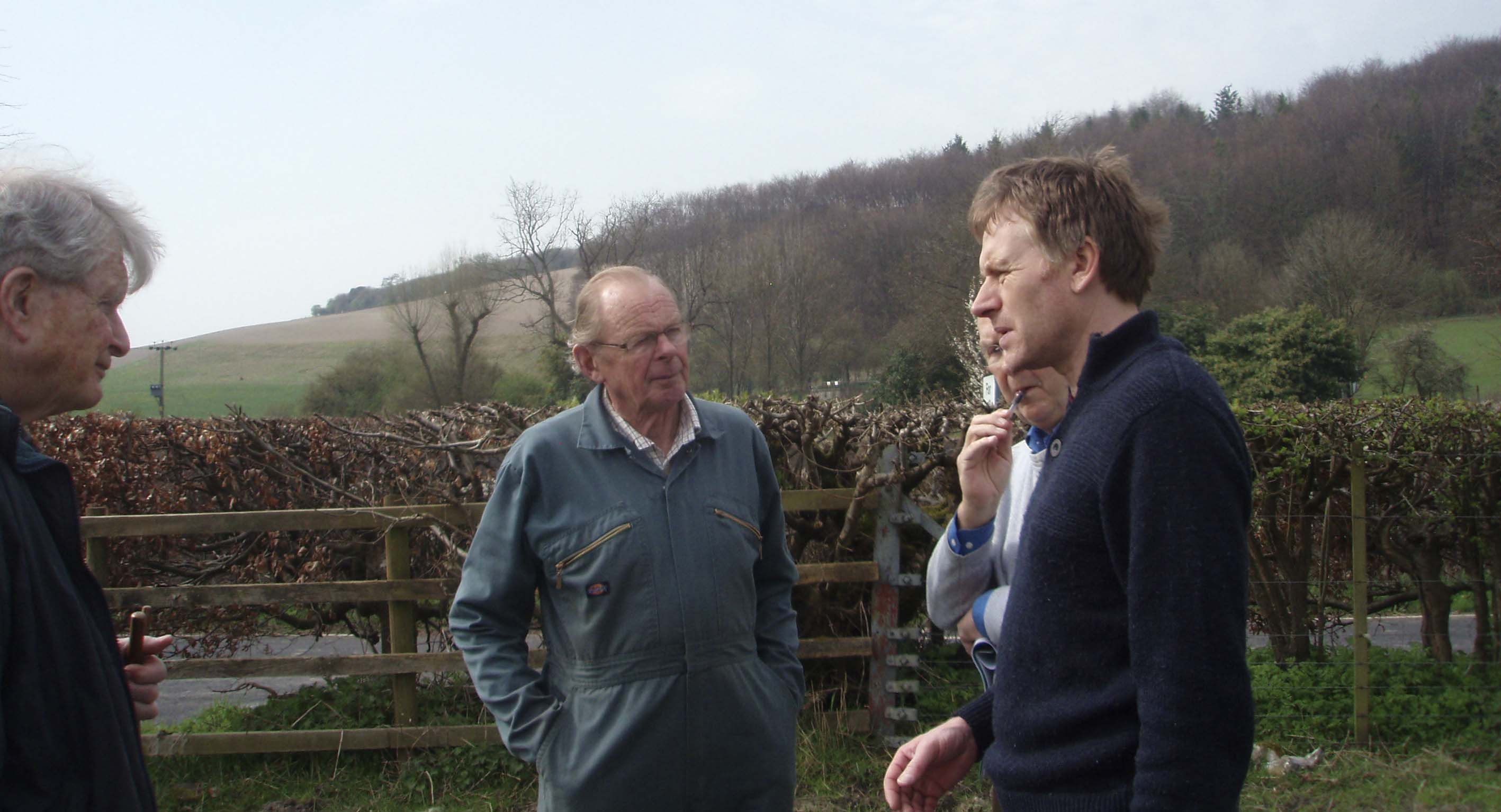
Surveying potential sites for the survey. Left to right, Guy Liardet, Chairman of Friends of Corhampton Church, Frank Moffatt, farmer, Michael Blakstad, EMHG. Nick Stoodley.
Nick Stoodley chose to reconnoitre land by the River Meon, from its source to Drayton bridge. He brought lists of Saxon objects previously found, mainly by metal detectors, at locations along its length, Michael and George Atkinson, Bill Tyrwhitt Drake and Frank Moffatt, kindly agreed to provide access to their land, (We are bound by confidentiality agreements not to reveal the chosen site … not all metal detectorists are honest!)
For two days in mid-September, History Group members and other villagers gathered to conduct the survey. Nick Stoodley led the exercise, and told the team why he had chosen the site; several Saxon objects had been found here, and its proximity to the village offered the possibility of finding a late Saxon settlement, a farmstead or a hamlet.
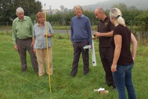
Our volunteers were coached by Carl Raven, a member of the Liss Archaeology Group, in the techniques to be employed in the geophysical survey, whilst three other members of the Saxons team guided them in metal detection. To ensure that the area was completely scanned, and the same ground not covered twice, a very precise grid was first created. Carl then coached our volunteers in the use of an electrical resistance meter to record resistance in the ground to an electrical current; for example the contents of a midden or pit will have a higher moisture content and consequently a lower resistance, compared to the surrounding earth.
Carl demonstrates magnetometer to David, Hilary, Alastair, Jenny
Peter Head digging for metal (which turned out to be a small lump of lead)
Next, Carl showed them how to use magnetometers, which measure variations in the earth’s magnetic field, reacting to metal and objects like brick and tiles which have had their magnetic properties altered by heat and record higher values than the surrounding earth.
Meanwhile, the metal detectors used GPS to note the location of any finds, which included Roman coins and a musket ball from the Civil War, but nothing from Saxon times.
The morning after … the scan shows no relevant traces.
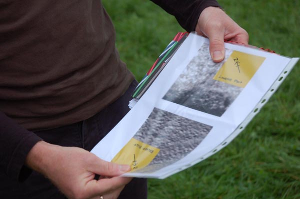
Carl showed us printouts of the scans … ‘great images, but nothing is detected’. In his final report he notes several ‘anomalies’ in the soil, but nothing to indicate a Saxon settlement. We can report that several members now know a lot more about the application of geophysical techniques in archaeology and who want to do more. But the secrets of Saxon East Meon remain under the buildings of the village.