Michael Blakstad is the 'publisher' of the East Meon History Group. His career was spent initially in broadcasting, in BBC TV, and both Yorkshire TV and Television South, and as in independent producer. His company Workhouse was a pioneer of interactive media. He lives in East Meon and manages the History website.
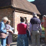
In May 2010, just after the East Meon History Group was founded, architectural historian Edward Roberts led its members around The Tudor House. Over the years, Edward had visited this house many times, and his research has vastly enhanced the knowledge of its history. For pictures of the tour, click here.
The Tudor House is also one of the buildings featured in the 2012 House Histories exhibition. For the content of this display, click here.
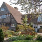
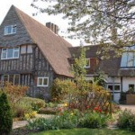
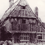
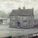
On the left, the Tudor wing added in the 1580s. To the right, the line of the old Hall House built in 1333.
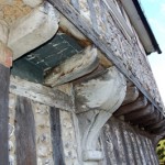
Tudor House, Close-studding and jetty – signs that Stephen Wright, who converted The Tudor House in the 1580s, was a wealthy man determined to demonstrate the fact.
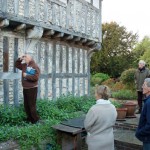
Edward Roberts at east end of Tudor House, part of the tour he conducted for the History Group in May 2012
The exterior and floor‐plan
Edward started, in fading light, outside the building, describing to the group the layout of the house. The original part of the building was a mediaeval Hall House, open from the hearth to the ceiling with no chimney – bricks were expensive in the 14th century. The hearth would have been stone. The central area would be open, with floored bays at one or both ends; the owners would have slept in the ‘best chamber’.
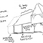
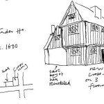
Edward’s notes describe how “The hall truss of a 2+ bay house survives. Given the site, it is possible that it butted onto a cross‐wing, as shown in the sketch”. In other words, there might have been either a third bay, reaching the present width of the house, or possibly a cross wing covering at least part of the footprint of the Tudor conversion.
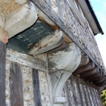
He took the group round to the east side of the house to point out the close studding – i.e. the lavish use of vertical timbers – and the jetty. This, again, demonstrated that the owner who built the Tudor house was a very prosperous person who wanted to show off his wealth.
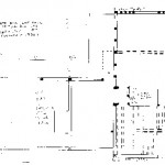
The house would have been entered from this side through a lobby which would have led straight to a double chimney breast, with the choice of turning right into the main chamber or left into a smaller room (see floor plan on next page). “It has a lobby‐entry plan with a fine ground‐floor chamber on the garden side, with crisp 3” chamfers to massive beams.”
In answer to a later question, Edward said that Hall Houses were built on the same pattern as each other, although there were discernible differences between neighbourhoods – for instance, the use of a crown post roof persisted into the 16th century just over the downs separating Hampshire from Sussex.
The truss beam (the mediaeval house)
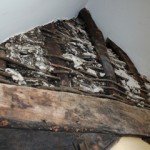
Edward took the group first to what is now a studio. To enable the building of the studio, the roof had been raised which means that the truss beam can now be clearly seen, the only part of the original hall house to have survived the Tudor re‐building. Edward pointed out the carving of the beam and the smoke-blackened wattle and daub which were the only remaining part of the original structure.
The Tudor House
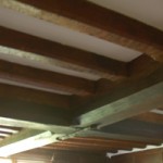
Edward took the group through the rest of the house, pointing out details of the construction and the carving as he went. He related that by the 16th century, smoke‐filled rooms were going out of fashion …. The sitting room has “crisp 3-inch chamfers to massive beams, windows and doors with good moulding, the latter with vase stops.” In the current dining room. Edward pointed out the carefully carved grooves on both sides of the central beam.
The present landing is a beautiful but puzzling double passage, on two levels with an open framework of beams separating each side. In the original house, the staircase would have been more central than its modern replacement. When the new stairs were built, the split‐level landing was created and the structure of the beams revealed.
In April 2011, Hampshire Records Office Archivist David Rymill gave the Group a talk on the Winchester Bishopric Pipe Rolls. This came at the end of an exhibition in The Court Hall of the Pipe Rolls.
Winchester Pipe Roll
Hare playing harp, from Pipe Roll/
Pipe Rolls exhibition in Court Hall, April 2011
Pipe Rolls exhibition stands
Pipe Rolls exhibition at Court Hall, East Meon
In the autumn of 1302, Nicholas de Ychen, the bailiff of the manor of East Meon, or possibly Richard Pokepole or Adam de Cumbe, one of the reeves or overseers there, picked up a quill and dipped it in an ink which he had perhaps mixed himself, using oak galls and ferrous sulphate bound together with gum Arabic. On a piece of parchment – the stretched skin of a sheep, possibly from this very manor he began to compile the accounts of the manor for the previous twelve months – possibly using data recorded since the previous Michaelmas on tally-sticks or a similar device.
First of all, they’d have looked back at the previous year’s accounts, recording a sum 0f £94 4s 10d ha’penny which had been paid in to the Bishop’s central treasury at Wolvesey Castle in Winchester. Then they moved on to the year that was just completed: the rents due at Christmas, Easter, St John the Baptist’s day (24 June) and Michaelmas (29 September) amounted to a little over £97 – but there were various deductions – it looks as if some people were being excused rent because they were serving as reeve, or doing ploughing, shepherding or swineherding; and account also had to be taken of land which wasn’t producing any rent that year because it had been taken back in hand, such as the pasture and wood which belonged to Thomas de Cumbe. Sometimes rent was paid in kind – William ate Bere and Andrew de Holeweye paid in cumin, and William Gilberd’ in a pair of gloves – which were duly handed over to estate HQ at Wolvesey.
There’s a long section called ‘issues of the manor’ which includes nearly £3 from pannage – payments for the right to turn pigs out for fodder, usually in the woods, with an explanatory note that there was no income from pannage in the park that year because of a lack of mast for the pigs to eat. There were various sums for pasturage – but none from the meadow below Godshull because it was mown that year. Income from wool was also listed – but that year there was no cash income from coarse wool and lambswool because it had been sent to Wolvesey – presumably it was wanted either in the bishop’s household or somewhere else on the estate. £6 15s came from summer cheese, 4s 33/4d from winter cheese, 9s from butter and over £2 from cider.
The livestock was itemised with care: 3 old and feeble plough horses were sold, and 7 oxen, 100 ewes fetched £5, and 19 pigs were sold at Michaelmas for 3s 6d each. Wheat, barley and oats brought in a total of nearly £112. The mill was let out, and brought in £1 15s. Tenants who paid standard sums on inheriting property or on marrying were listed at length: Nicholas, son of Nicholas de Langriss’ paid £2 10s for the right to succeed to his late father’s property in East Meon; Peter ate Bure paid £1 to marry Christina, widow of John Crispyn, and take on her land; Agnes Fermyn paid 1s for marrying her daughter ‘outside’ (to someone outside the manor, I presume).
There were lots of fines – Adam Kay was fined 3s ‘for having his pigs at the barn door’, and Adam Kay the younger 6s 8d ‘for keeping the plough-horses badly’, while Alice, daughter of Richard de Naddenham, Ralph at Stupe and their fellows were fined 4s ‘for many transgressions’. Altogether the receipts came to £270 1s 111/2d.
The other side of the account, the expenditure, is listed with equal care: expenses relating to ploughs amounted to over £15, ranging from ironwork at 14s 3d to 1s ‘for hiring men for the ploughs when they plough after dinner’; 17s was spent on work on the carts, and 4d on doctoring horses was included in this. In the dairy, buying salt, repairing buckets and utensils, and so on was all itemised. The buildings this year accounted for only 12s 4d, including 3s 10d on roofing and pending the barn beside the pinfold (or movable pen) and other buildings, and repairing the barley barn which had collapsed. Harvest-time brought its own expenditure: although much of the work was carried out as a matter of obligation, the estate provided a farthing’s worth of bread and 2 herrings or one cheese for each. The total expenditure in East Meon was £39 5s 71/2d.
After the income and expenditure, there’s an account of the crops produced – mainly wheat, barley and oats, showing amounts used on the manor for animal fodder (and, like the men, the plough-horses got something extra when they ploughed after dinner). And there’s also a detailed account of the livestock – to give one example, pigs: 35 adult pigs remained from the previous year, 28 which had been counted as hoggets in the previous year – that’s pigs in their first or second year – were now redefined as pigs, 19 were sold, 4 were sick – balance 50; there had been 50 hoggets from the previous year’s piglets, 10 were sick, 2 had been redefined as sows and 38 as male pigs, so none of last year’s hoggets were still hoggets. 45 piglets had been born from the sows that year, and 8 had come from the reeve of East Meon Church, the smaller manor in East Meon. 9 were sick, so that left 44. And I could go on in the same way about horses, cattle, sheep, hens, and swans. Oh, and if you want to know about peacocks and peahens – 6 from the previous year, one sick,no offspring this year, balance 5.
And having done all this accounting, Nicholas de Ychen had to pop round to East Meon Church manor and start all round again with the reeve there, Robert Hugh’. Perhaps he deserved the 3s he claimed at East Meon for fur for his summer livery!
Seven centuries later, the accounts which Nicholas and his colleagues were producing are used by local, family and academic historians studying the history of farming, buildings, and even the weather. What we have surviving, for the most part, is not the original account rolls written by Nicholas and the reeves, although for some years we do have those, but for many more years we have the series of faircopy annual accounts of the Bishopric estates, which by the late 13th century had become known as pipe rolls. Each consists of about thirty membranes of parchment, with about eighty long lines of writing on each side, stitched together at the top and then rolled for storage.
The pipe rolls stretch in an incomplete sequence from 1209 to 1711, with 330 years represented. There is, not surprisingly, a gap for the period of the Civil War and Commonwealth, when the bishopric estate was dispersed, but the sequence resumes in 1663/4. The first 191 surviving rolls, down to 1455, are indeed in roll format. By 1457 they were being bound into book format. They cover the period from one Michaelmas (29 September) to the next Michaelmas.
Peter des Roches, Bishop of Winchester from 1205, probably first ordered the pipe rolls to be kept. He would have been familiar with the King’s annual audit accounts which are also known as Pipe Rolls. Bishop des Roches was influential both within and beyond the diocese: he was effectively regent of England during King John’s absence in 1214, and he is said to have been involved in the rebuilding of the walls of Jerusalem in the 1220s. Under des Roches the income of the estates doubled to £3000 a year; although his household accounts do not survive to show us the way in which much of the money was spent, some of it may have gone towards the foundation of monasteries at Titchfield, Selborne, Netley and elsewhere, and to fund hospitals at Southwark and Portsmouth.
Why was this complex system of accounting introduced on the Bishop’s estates? On small estates with a resident lord, there was little need to keep formal accounts, as the lord could keep a close eye on the administration. In contrast, the Winchester Bishopric estate was one of the largest estates in England, spread across seven counties, so a complex administrative system was required.
The Winchester pipe rolls are just the last stage in the accounting process. The day-to-day running of each manor was entrusted to one of the local people, known as the reeve. Manors were grouped together into bailiwicks, each run by a bailiff. The chief administrative officer was the steward, who for most of the medieval period was based at Wolvesey, the Bishop’s palace in Winchester. As well as overseeing the accounts, he would have been responsible for instructing officials on each manor in any particular crops that were to be grown for use elsewhere on the estate (for instance, barley which could be sent to the malt-house in Bishops Sutton and then to the brewhouse at Wolvesey to be made into ale).
The reeve for each manor submitted his annual accounts, perhaps with the help of the bailiff, and these would then be checked by auditors. Occasionally the preliminary accounts – known as compotus rolls – do survive, showing the changes made by the auditors.
The Bishops of Winchester enjoyed the richest episcopal estate in England. It was more lucrative than that of the Archbishops of Canterbury, and perhaps the second richest in Europe, producing an annual income of about £4000 in the late 13th century. It comprised about sixty manors, roughly half of them in Hampshire (especially in mid-southern Hampshire, in and around the Meon valley, and in the extreme north), with three in Surrey (which was also part of the Diocese of Winchester), and the others scattered across southern England from Buckinghamshire to Somerset. Many of them had been given to the bishops by successive Kings of Wessex between the 7th and 10th centuries, but there were some changes in the composition of the estate during the Middle Ages.
Although the rolls were administrative documents, some scribes occasionally allowed themselves flights of fancy, decorating them with dragons, ornate versions of the manor names, and other animals, such as a hare – or fox – shown playing a harp in the decorated initial capital of the 1337 roll.
Despite this apparent playfulness, the auditing process was a serious business. This extract from the original Droxford for 1410 shows the account for the sheepcote. In the top line there was a claim for 8s for two barrels of tar (which provided protection against parasites), and 8s 6d for grease, but these figures have been deleted by the auditors, and changed to one barrel at 4s, and 6s 8d for grease.
Similarly, in the last line, a claim for 6s 8d for the annual stipend of the shepherd of hoggs (sheep in their second year) has been reduced to 3s – although he was still better off than the dairymaid who got two shillings. The pipe roll entry for Droxford, copied from the compotus roll, only gives the approved figures. For centuries the rolls were kept at Wolvesey, but in 1858, as part of a national process of reform of bishops’ estates, the Winchester bishopric estates, together with the records, were transferred to the Ecclesiastical Commissioners for England (now the Church Commissioners). The records passed to the Public Record Office in Chancery Lane (now The National Archives, at Kew) in about 1890. Dr Hubert Hall, who was both a senior clerk at the PRO and a lecturer at the London School of Economics in search of medieval agricultural records, led several seminars which studied the rolls and published an edition of the 1209 roll in 1903. The seminar members also visited Winchester in 1903 and discovered the 1254 roll at the Cathedral; it was restored to its place in the series. In the 1920s, seminar members discovered flaws in the old departmental list which formed the only means of access, and they began checking the dates of the rolls and searching for others hidden under the description Miscellanea; thirteen previously unknown rolls were identified. The rolls remained at Chancery Lane until 1959 when they were transferred to Hampshire Record Office.
For many years the rolls were probably used mainly by fairly experienced by historians, perhaps investigating trends in agricultural history, or specific buildings. To most potential users, however, they remained very intimidating, because of their language, handwriting and accounting methods. At the Record Office we were very keen to open them up to a wider audience, and so Hampshire County Council, of which we are a section, funded the first six years of the Pipe Rolls Project, based at the Record Office, which resulted in the publication of English translations of two rolls, those for 1302 and 1410, edited by Dr Mark Page. A Latin edition of the first surviving roll had been edited by Dr Hall’s class many years earlier, and recently an English translation of that has been published by the local historian Harold Barstow. Although that’s only three years out of 330, they can be used as templates, helping you to get to grips with the layout and style of the pipe rolls – and the idea is that this will make it easier to pick out entries for East Meon in rolls for other years, and work through them. Copies of Mark Page’s two translations are available for sale or
consultation at the Record Office. The Pipe Rolls Project was then continued by Dr Page and Dr John Mullan, with a study of the operation of the land market, funded by
the Economic and Social Research Council and the Leverhulme Trust.
The rolls are stored wrapped in acid free material, in specially-made boxes, to ensure their long-term survival. To reduce wear and tear on the original rolls, we’ve made microfiche copies of all the early rolls.
So – what do the rolls tell us about life in East Meon, and the Bishop’s other manors, in the Middle Ages? The earlier medieval rolls are the most interesting to agricultural historians, because until the 15th century most manors were kept ‘in hand’ – that is to say, managed directly for the bishop – so the accounts for each manor list in minute detail the agricultural produce, and all expenditure incurred. By contrast, from the 15th century most manors were leased to tenants, known as ‘farmers’ (from the phrase to ‘farm out’, meaning to lease out), so there was little to record except the annual rent payment, because increases and decreases in livestock and crops were now the responsibility of the ‘farmer’.
Successive historians have studied the rolls in great detail for the light they shed on agricultural and economic history, especially crop yields, suggesting a relationship between the weather, yields and some aspects of social stability.
The accounts for each manor are generally divided into four main sections, as I indicated in the East Meon example at the beginning:
– cash receipts
– cash expenditure, including construction and maintenance of buildings, agricultural expenses, food for workers, and hospitality for guests
– the grain account, recording for each crop the balance from the previous year, the latest yields, and how it had been disposed of (provisions, seed,
fodder, sold and in hand)
– the stock account, recording the balance for each type of animal, and the numbers born or bought, and slaughtered, sold or transferred.
The first membrane of the 1302 pipe roll begins with the account for Taunton (Tauntona) in Somerset. This was the bishopric’s most westerly and richest manor. In 1301-2, £365 was paid into the bishop’s treasury at Wolvesey, and a further £230 was owed at Michaelmas. The headings in the margin name the manor’s numerous mills (molend’), and the accounts detail the amount of corn – wheat, oatmeal, maslin, first and second grade malt – sold from each. The mill at Corfe is said to stand idle because of a lack of water (stat otiosum pro defectu aque), a frequent occurrence because the village depended on a small stream from the Blackdown Hills which was prone to drought. The constable of Taunton, Philip de Paunton, also recorded that £103 of the manor’s arrears was in the hands of the Wiltshire coroner because the money was found on the body of a dead man (quia inventa fuit super quendam occisum).
The stock account for the manor of Droxford in 1302 lists the animals and dairy produce, following a standard pattern. As the marginal headings show, these begin with the cart-horses (equi carrectarii) and continue with the plough-horses (affri) and the oxen (boves). Cheese (caseus yemalis and caseus estivalis) usually heads the list of the dairy and animal products sold on the manor during the year. At Droxford 160 cheeses, each probably weighing around sixteen pounds, had been made since 29 April. Several were given away to the chaplain, reeve and shepherd as customarydues, but most were sold. A record of household goods (utensilia) brings the Droxford stock account to a close: it lists a brass pan, a basin with a ewer and a brass pot.
Medieval tenants were required to perform labour-services on the bishop’s land, as well as cultivating their own lands. The rolls don’t actually set out what these services were, but they do often allude to them, either because the tenants had paid to be excused the services or because the manor had to buy-in additional labour.
Even in the last pipe rolls there are still references to the sale of labour-services; one imagines that by this time no tenants would actually have been carrying out the work in person.
The structure of the families who were working on the manors may also be revealed. Tenants of the manors were liable to pay ‘fines’ (fixed charges – not penalties in the modern sense of the word fine) when they took over land, or when their daughters married. Sometimes sufficient information about inheritance or marriage is given to be enable the family historian to identify a marriage or death – perhaps several centuries before the introduction of parish registers in 1538. For instance, at Cheriton in 1302 Joan le Swon paid a fine to take over the land which had been held by her late husband Henry, and then John de Spin’ paid ‘to have the said Joan le Swon with her land’, while Robert Jan paid to have land from the inheritance of his mother, the widow of one Cartere.]
For the local historian, perhaps the most exciting feature of the earlier Pipe Rolls is the rich detail of building projects and maintenance, relating both to higher-status buildings such as the bishop’s castles (some of which can still be visited today), and to more humble farmhouses. Among the higher-status buildings was Farnham Castle, originally built or fortified in the twelfth century, and a favourite residence of the bishops of Winchester, who especially valued its deer park. As the practice of travelling from one residence to another declined, it became their principal residence, and remained so until 1927 when the diocese was divided and Farnham became part of the Diocese of Guildford. Since 1962 it has been the home of the International Briefing and Conference Centre (then known as the Overseas Service College).
The 1410 pipe roll account for Farnham Castle includes £2 paid to ‘Thomas Glasyer of Selborne remaking anew the windows of the lord’s chamber, chapel and hall, broken by the great wind’ (cum magn’ vent’), and 2s 6d paid to William Bagge for mending the ironwork of the windows of the lord’s chamber. The pipe roll for 1301-2 tells us about the expenditure on the castle buildings, arms, and the park and fishponds (custus parci et vivar’) at Farnham. During that year, quite substantial work was carried out at the castle. The corner tower ‘facing the vill’ was pulled down by order of the bishop, its foundations examined and cleaned and a new tower constructed. A new bridge was also built, and the park palisade repaired where it had been blown down by stormy winds (per tempestatem venti).
Bishops Waltham Palace, an important residence on a Hampshire manor held by the bishops since 904, was transformed by two bishops, William of Wykeham and Henry Beaufort, between 1367 and 1447. Dr John Hare has searched the pipe rolls (and compotus rolls) to piece together the story of these changes. In 1378-81 Wykeham rebuilt the great hall, and constructed a new bakehouse and brewhouse; later in the 1380s about £300 was spent on the kitchen, larder, etc, and the 1390s saw alterations to the bishop’s great chamber.
The pipe roll for 1301-2 tells us about the expenditure on the castle buildings, arms, and the park and fishponds (custus parci et vivar’) at Farnham. During that year, quite substantial work was carried out at the castle. The corner tower ‘facing the vill’ was pulled down by order of the bishop, its foundations examined and cleaned and a new tower constructed. A new bridge was also built, and the park palisade repaired where it had been blown down by stormy winds (per tempestatem venti).
Bishops Waltham Palace, an important residence on a Hampshire manor held by the bishops since 904, was transformed by two bishops, William of Wykeham and Henry Beaufort, between 1367 and 1447. Dr John Hare has searched the pipe rolls (and compotus rolls) to piece together the story of these changes. In 1378-81 Wykeham rebuilt the great hall, and constructed a new bakehouse and brewhouse; later in the 1380s about £300 was spent on the kitchen, larder, etc, and the 1390s saw alterations to the bishop’s great chamber.
And now for a really local example – East Meon Court House, although smaller than the great residences, was used for short visits by successive bishops, perhaps as a country retreat, and also provided a usual base for the steward on his visits. By 1209 it already had a hall, chamber, kitchen and fishpond, and in 1285 a glazier was paid for work there, at a time when few houses had glazed windows. Edward Roberts and other researchers have found references to it in many of the rolls, notably in the 1390s when William of Wykeham rebuilt the hall and a chamber block (and again in the 1430s-40s when Henry Beaufort refurbished the house). In 1396 the large sum of £17 13s 4d was spent on timber from the Abbot of Durford in Sussex, presumably a special shape of timber which was not available on the bishop’s manors – perhaps the great tie-beams for the hall.
This is a printout from the 1397 roll. As is usual with the medieval Pipe Rolls, the text looks quite dense but you do get headings to assist you – both telling you which manor is being talked about – you can see Meone Eccl(es)ia adhuc (‘still’ – presumably meaning ‘continued from overleaf’) at the top – and also for the sections of the account, many of them beginning ‘Custus’, i.e. cost. The first thing I’ve underlined in red is ‘Custus domorum’ – cost of houses – and later there is a heading, more or less on the middle of this sheet, ‘De nov’ aedific’ aul’ et cam’ – for rebuilding the hall and chamber. Towards the end of this extract there’s a mention of the eight corbels which were carved by a mason in Winchester on the instruction of the master mason William Wynford – I’ve underlined the words viiij corbell’ and magist’ Willi’ Wynford.
Another house on the bishopric estate where bishops sometimes stayed, and which is still occupied, is Manor Farm, Hambledon – occasionally used by the bishops until the mid-14th century. Some of the roof-timbers have been ring-dated to 1473-8, which has enabled Edward Roberts to locate in the 1477 pipe roll the account for rebuilding the roof of the steward’s outer chamber on the first floor of the east block. The first-floor chambers would have provided a suite of rooms for the steward of the whole bishopric estate, on his visits to hold courts, and at other times would have been available for use by the tenant.
The 1477 roll gives a total of £8 5s 8d spent on the new roof, including 15s for 6,000 slates bought at Fareham (which had probably come by sea from Devon), down to 12d spent on three bushels of tilepins (tilepynnys). The walls and chimneys were repaired using stone from nearby Langrish and from the Isle of Wight.
But the Pipe Rolls aren’t just about farming and building construction: they can also give us insights into many aspects of the highs and lows of medieval life. Town planning, for instance: in the 13th century the bishops established new six new towns within manors on their estates. Some such as New Alresford, established in 1200, remain thriving communities.
Newtown in Calbourne manor on the Isle of Wight, also known as Francheville or Swainston, was founded in the 1250s and was at one time a successful Solent port. The 1257 roll shows the first half-year’s rents for plots in the Calbourne Newtown, with the bold heading ‘Franchevile’. Initially there were 73 plots; some tenants occupied two or more, at a rent of sixpence per plot for the half-year. Entries in the pipe rolls for planned towns, where all the property was let, are much shorter than for rural manors which were managed directly.
So we get entries like: …per dimidium annum. Et de vi d de Willelmo de bosco pro i placea per idem tempus. Et xviii d de Eugenia de Aretleya pro iii placeis …for half a year. And in 6d from William Wood for one plot for the same time. And in 18d from Eugenia de Aretley for three plots 11M59/B1/27. Perhaps as a result of competition from Yarmouth and Southampton, and reductions in the population in the surrounding area, Newtown declined, and only eleven houses were mentioned in the 1674 Hearth Tax.
I visited Newtown last summer – you can go inside the exquisite little Town Hall, marooned in the countryside, now run by the National Trust, and continue on to the harbour – an eerily windswept place even on a fine summer’s day. The new borough of Overton was established in the 1210s. We hold a map made in 1795, which still shows the contrast between the grid pattern of the planned town, on the south, and the old village around the church, surrounded by the strip-fields of the remaining part of the manor, on the north. Along the town streets, a few of the burgage-plots, house-plots with long thin gardens, are shown. Many decades after the town’s foundation, the reeve still included an entry in his accounts noting that certain old agricultural rents were no longer paid because the land in question had been taken for the new town – an example of the way in which the information in the Pipe Rolls tended to become somewhat fossilised.
Accounts of St Giles’s Fair, held annually on St Giles’s Hill on the eastern side of Winchester, and arguably the greatest fair south of the Thames, can be found under the heading Compotus Feriae Sancti Egidii. The 1410 pipe roll entry records a steep decline, with receipts of only £17 1/2d compared to £56 7s. 21/2d. in 1302. The account lists income under the headings ground rents (terragium), leases (locagium) and tolls on cattle (boagium) with customs and tolls. Expenditure included 11d on roofing the pavilion (papill’) and lord’s shop (shopam).
Sometimes the pipe rolls give us a hint of the impact of national events on the lives of the bishops’ tenants and servants. The Black Death reached England in 1348, and the pipe roll produced at Michaelmas 1349 must have been written by clerks who had seen the horrors of this unprecedented plague. One might think that, in the traumatic circumstances, they wouldn’t have had time or inclination to make such a good job of the roll as usual – but in fact it is as neat as ever, and contains the usual information just as if life was continuing as normal. The only clue is its bulk – 43 membranes compared to 28 in 1343 – giving an indication of the many additional entries recording greater numbers of deaths and changes of ownership, and more use of hired labour because they were fewer tenants undertaking labour-service obligations. In later years there are headings such as Defectus redditus et operum per pestilentiam – default in rent and works through the pestilence. Some manors recorded the names of tenants who had apparently died – probably many, although not necessarily all, through plague – leaving no-one to succeed them and take on the
land, such as Alice Gillies and John Appelhurst at Hambledon, and Agnes Aleyn and Matilda Weyland at Merdon.
More localised disasters, such as bad weather and disease of animals, could have an impact on particular manors, which was then reflected in their accounts. In 1302 numerous plots of land at Gosport paid no rent because they had been inundated by the sea, and many manors recorded livestock affected by murrain. The year 1301-2 appears to have been especially blusterous, necessitating an unusual amount of repair work, particularly to the roof-covering of the estate’s agricultural buildings. In the account of the cost of repairing manorial buildings (headed custus domorum) at Overton, the reeve stated that the wheat and oats barn (probably thatched) had been unroofed by the wind (per ventum discoopert’). Also suffering damage were the bakehouse, dovecote and kitchen. The bakehouse was reroofed using 35 acres of stubble (stipula), whilst 4,000 tiles (tegulis) were bought for the dovecote and kitchen.
The rolls can also help us to reconstruct the route taken by the bishop around his various castles and manors, and the dignitaries who stayed there. This is especially useful for the years before 1282, when the series of surviving bishops’ registers begins – after that point, the register often record where they were when they issued official decisions. The 1302 account for Wolvesey reveals that 8d was spent in cleaning the buildings in preparation for the visit of the Earl of Lincoln and the Count of Savoy.
The rolls can be revealing about political history: they show that the future Henry III was entrusted to the keeping of Bishop des Roches in 1212, four years before other sources tell us that the bishop took him into his care on the death of King John. In the 1220 roll, when the bishop was still caring for the young king, we can follow his progress around Brightwell, Downton, Farnham and Taunton, thanks to the accounts of food and drink supplied. Henry’s sister Eleanor was maintained at the bishop’s castle in Taunton in the 1210s, and the rolls record expenditure on candles, robes,soap and so on. During the renewed struggle between crown and barons in the 1260s, the rolls record the payment of a watchman with hounds at Farnham, a low figure of 46s for pasturage at Southwark quia destructum fuit per homines London’ in Guerra – because it was destroyed by the men of London during the war – and at Wolvesey two carthorses were lost in depredatione in Guerra per exercitum domini Symnois de Monteforti – in a depredation in the war by the army of the lord Simon de Montfort.
The pipe rolls and other estate records are not primarily concerned with the bishops’ spiritual work – that is the subject of the equally fine series of diocesan records surviving from 1282 and also held at Hampshire Record Office. However, there are references to the distribution of grain or bread to the poor (for instance, during the economic crisis of 1258), and occasionally we are given glimpses of the rich ritual of pre-Reformation practice in the diocese. The 1302 pipe roll entry for Bishop’s Waltham contains an inventory of the books, ecclesiastical vestments and plate (ornamenta) kept at Bishops Waltham. They include one antiphoner (book of anthems), two legendaries (books of saints’ lives), one missal (mass-book), and vestments including an alb (white robe) with a hood, a maniple, a stole and a chasuble, as well as a chalice with a paten.
The rolls were written in a variety of typical medieval hands until 1602 – by which time they’d long since ceased to be typical elsewhere, so one must assume that clerks taking up a post in the estate HQ at Wolvesey would have deliberately learned this rather archaic hand – just as clerks in central Government departments were taught different styles of handwriting if they worked in the Exchequer or Chancery, and writing-masters prided themselves on the number of different hands they could teach. There were, nonetheless, minor individual features, and sometimes it is possible to work out that a particular roll was produced by several different clerks who had slightly different styles. In 1603 the handwriting changed to the style known as ‘secretary’, which had become common for most purposes in the 16th century, and indeed by then had already been abandoned by some in favour of Italic, which is much closer to modern handwriting. Roman numerals are used for the thousands of sums of money and numbers of livestock recorded in the rolls. The system, in which i represents 1, v represents 5, x is 10 and so on, has no symbol for 0 and so does not use columns as in the familiar Arabic system. Not surprisingly, there are frequently mistakes in the copying of the figures – and the fact that they may still end up with the right answer is a reminder that the pipe rolls are copied from other documents.
It may be a surprise to find that the Pipe Rolls are written in Latin, not only in medieval times, but even down to the final surviving roll produced in 1711. But in fact Latin remained the language of some official documents, including many records of the Westminster law courts such as Chancery, and manor court records, until 1733. Fortunately for the modern researcher, dealing with the formalised Latin found in records like this is generally easier than reading the works of those whose first language was Latin. Some of the estate clerks may not have known much more Latin than the standard phrases that were used year after year. Sometimes the clerks found themselves faced with a word which had to be included, but for which they did not know the Latin. Some words may not even have had a Latin equivalent, especially if they related to improvements made in farming, building or milling technology since Roman times. In these cases the clerk had two options:
to slip into English, usually introducing an English word with the Latin ‘vocatur’ – ‘called’ – or to invent a new Latin word, drawing on existing Latin or English roots.
In the rolls there are Latin words for hundreds of activities and for the implements used which reflect the daily domestic and agricultural tasks of ordinary people working on the estate. A large number of these words are not recorded as Classical Latin words and are derived from vernacular languages, primarily English and French. For example, we find here the Latin word ALGEUM meaning a water-trough for a mill: in 1209 four shillings and two pence was paid for the construction of one of these. From the earliest Pipe roll we have the word HOGGETTUM, a diminutive from the Middle English HOGGE, meaning both a pig in its second year and apparently a young sheep. We also find POTTUM in its more specialised meaning of a pot-shaped vessel used as a fish-trap, a word deriving from the Anglo-Saxon word POT: an unspecified number of these was made in 1271 at a cost of sixpence. Other words connected with eating are PUDINGUM, meaning a sort of sausage, and
REISINA (the earliest form of the modern English ‘raisin’ deriving from Classical Latin RACEMUS meaning a bunch of grapes). We find such words as PILARE (to pluck sheep’s wool), REFALCARE (to mow again), PINNARE (to fill with bits of masonry), and PINIONARE (to clip a bird’s wings). These two words, deriving from Middle English, still exist in the modern English forms ‘to pin’ (in the sense of filling a wall with masonry) and ‘to pinion’. In these accounts we find the earliest example of PICHERA meaning an earthenware vessel or jug, deriving from the Middle English PICHER and surviving in modern English ‘pitcher’. A less obvious instance of a word that has survived into the modern period but which is first used in a Latin form in the Pipe rolls is the word PENTICIUM meaning a simple structure added to a building to provide shelter: this word derives through the Middle English and Old French forms PENTIS and PENTICE but goes back to the Classical Latin word APPENDIX meaning ‘an appendage’; in turn it is later transformed into the modern English word ‘penthouse’, although in Winchester the name Pentice is still used for the colonnade in the High Street.
We also find some unusual words that have so far only been found in the Winchester Pipe Rolls, possibly invented for use on one occasion! – words such as QUERNESTRAGUM, meaning a wooden tray for a hand-mill, derived from Middle English QUERN (mill) and TREI (tray; from Anglo-Saxon TREG), SPLOTGABALUM meaning a payment made for permission to pasture cattle, deriving from Anglo-Saxon SPLOT (a piece of land) and GAFOL (tax or rent) and POTFALDA meaning the practice of establishing temporary enclosure for domestic animals on another person’s land, a word deriving from Middle English POTEN (to put) and Anglo-Saxon FALDA (an enclosure or fold). This word occurs in the Pipe rolls repeatedly from 1209, and its specific meaning is made particularly clear in the 1401 roll, which explicitly records that no payment has been made in that year for the temporary enclosure of the breeding ewes, because no such enclosure was needed.
However, it is not only words that are peculiar to Medieval Latin that can produce interesting entries. in one entry, dating from 1287, we read that ‘twenty two pence halfpenny was paid for 1500 frogs, at a penny halfpenny per hundred, to feed the fishes’ where the Classical Latin words for frog (RANA) and fish (PISCIS) are used. Perhaps the greatest difference between English and Latin is that, whereas English the Middle English HOGGE, meaning both a pig in its second year and apparently a young sheep. We also find POTTUM in its more specialised meaning of a pot-shaped vessel used as a fish-trap, a word deriving from the Anglo-Saxon word POT: an unspecified number of these was made in 1271 at a cost of sixpence. Other words connected with eating are PUDINGUM, meaning a sort of sausage, and REISINA (the earliest form of the modern English ‘raisin’ deriving from Classical Latin RACEMUS meaning a bunch of grapes).
We find such words as PILARE (to pluck sheep’s wool), REFALCARE (to mow again), PINNARE (to fill with bits of masonry), and PINIONARE (to clip a bird’s wings). These two words, deriving from Middle English, still exist in the modern English forms ‘to pin’ (in the sense of filling a wall with masonry) and ‘to pinion’.
In these accounts we find the earliest example of PICHERA meaning an earthenware vessel or jug, deriving from the Middle English PICHER and surviving in modern English ‘pitcher’. A less obvious instance of a word that has survived into the modern period but which is first used in a Latin form in the Pipe rolls is the word PENTICIUM meaning a simple structure added to a building to provide shelter: this word derives through the Middle English and Old French forms PENTIS and PENTICE but goes back to the Classical Latin word APPENDIX meaning ‘an appendage’; in turn it is later transformed into the modern English word ‘penthouse’, although in Winchester the name Pentice is still used for the colonnade in the High Street.
We also find some unusual words that have so far only been found in the Winchester Pipe Rolls, possibly invented for use on one occasion! – words such as QUERNESTRAGUM, meaning a wooden tray for a hand-mill, derived from Middle English QUERN (mill) and TREI (tray; from Anglo-Saxon TREG), SPLOTGABALUM meaning a payment made for permission to pasture cattle, deriving from Anglo-Saxon SPLOT (a piece of land) and GAFOL (tax or rent) and POTFALDA meaning the practice of establishing temporary enclosure for domestic animals on another person’s land, a word deriving from Middle English POTEN (to put) and Anglo-Saxon FALDA (an enclosure or fold). This word occurs in the Pipe rolls repeatedly from 1209, and its specific meaning is made particularly clear in the 1401 roll, which explicitly records that no payment has been made in that year for the temporary enclosure of the breeding ewes, because no such enclosure was needed.
However, it is not only words that are peculiar to Medieval Latin that can produce interesting entries. in one entry, dating from 1287, we read that ‘twenty two pence halfpenny was paid for 1500 frogs, at a penny halfpenny per hundred, to feed the fishes’ where the Classical Latin words for frog (RANA) and fish (PISCIS) are used.
Perhaps the greatest difference between English and Latin is that, whereas English The transactions in the manor courts are recorded in a series known as fine books –the word ’fine’ indicating the payment made by an incoming tenant who had inherited or bought the property – sometimes known as an ‘entry fine’. These fine books cover all the manors which used this system, and are arranged by date, but there are very useful indexes, and each manor usually has its own index – covering the period 1660 to 1935.
In the index for East Meon manor, you can look for the name of any person that you know held your property, and you will find the date of the court when he or she was admitted tenant. This will normally be in the form of the letter H or M for Hock or Martinmas, indicating the spring or autumn court, followed by the year, often in the form of the regnal year, the year within the current monarch’s reign. So if you see MGeo II it will mean the Martinmas court in the 12th year of George II – which by my reckoning was in autumn of 1738. You can then get out the fine book or books for that year and find the entry. Of course, some tenants held more than one property and you will need to make sure you are looking at the right one.
Once you have got the right one, spotting it in the indexes again is usually not too difficult, because different properties were normally subject to different entry fines, but, like the property descriptions, the fine on any given property normally stays the same – unless the property is divided, in which case it is split between the parts. Very usefully, the fine book indexes, also give you columns indicating the dates of the previous and subsequent transactions for that property – it was a really well organised system. In the actual fine books the date of the previous transaction is given at the top of the entry so even when you have got back before the start of the indexes in 1660 you still have quite a good chance of getting back to the beginning of the fine books series in 1540. Generally the fine books are in Latin, before the mid 18th century, but they follow such a standard formula that, if you’ve read the later entries in English you won’t need a huge amount of help to work out what’s going on in the Latin entries.
So I hope I have inspired you to come in and use the Bishopric archive, either to trace your own house through the fine books, or to use the Pipe Rolls as a way of studying life on the medieval manor – perhaps getting a little closer to understanding what day-to-day life was like for your predecessors in the village as they ploughed and harrowed their lord’s fields, worked their own strips of land, and coped with the perils of disease, storm, drought, and those Episcopal officials who kept on writing everything down.
Nick Barratt briefed the History Group on November 1st 2011, at the start of our House Histories project. These are notes on his talk.
Nick gained a PhD at Kings College, London and joined the National Archives: Public Record Office at Kew as a reader/adviser.
He worked as a specialist archive researcher for the first series of BBC TV’s ‘Who Do You Think You Are, and has subsequently presented numerous television series including Hidden House Histories (History Channel), and You Don’t Know You’re Born (ITV1)
Nick Barratt
Nick Barratt with Sarah Webster, who organised the talk
Nick Barratt with Michael Blakstad, who wrote these notes.
Applause at the end of the talk
Introduction
They do it by magic on television. In reality, a lot of hard work requiring a systematic approach.
What do you want to find out?
Do you want to know when the house was built, who lived in the house, about the local community?
Be flexible! Local study centre best place for information, n.b. Victoria County History.
Place names change! So do boundaries, ownership &c, and places of occupation.
Cast the net wide – street or community.
Work back in time
Start in the present day, current administrative area &c, then work back. Use a modern map marked with historic administrative boundaries. Keep a list of owners and occupiers.
Sources
Framework documents – 20th century occupancy records, 1910 valuation office, tithe apportionments, census returns.
Electoral lists (arranged alphabetically by street). Rate books, trade and street directories.
Ordnance Survey Maps – track the property through time.
Architectural clues
Local vernacular often different from trends elsewhere – look at other houses in village. Houses closest to centre of village are usually the oldest. Salvage materials often used in construction. Rebuilds after fires often misleading. ‘Retrospective’ architectural styles can also mislead. Top or bottom of buildings usually oldest. Interior clues important as well as exterior.
Use of building often changes.
Look for design registers, inventories and insurance records. www.hiddenhousehistory.co.uk.
Archives
Start locally – Local Studies or HRO. Then national resources, National Archive, British Library or Family Records Office.
Electoral lists – ward/street/house.
Rate books – use in combination with electoral lists – details of both occupiers and owners.
Directories – street/trade/tenants
Valuation Office Survey
1910 Finance & Property Act. Valuation of land and property. The country was divided into districts and sub-districts, surveyors sent out (not flattering descriptions!) Snapshot of owners and occupiers.
Based on O/S maps 1894 – 1904. Maps have yellow/red borders marked. (Use copy of modern map to copy lines.)
Field books – TNA series IR58 (searchable on TNA Catalogue). Information arranged by valuation district (see Ordnance Survey map for details). Continued up to WWI.
Details include: Owner, Occupier, Interest, Description.
Census returns
1841 – 1911 (work backwards)
Records 0wner/occupier. House names may have changed (but surveyors recorded their walking routes). Importance of local occupations/industries. Context!
Tithe Apportionments
1840s, assessment of tithe liability. Covers areas with residual tithes, arranged by parish.
Maps show liable plots of land or property, not the name of the property, each with tithe rent, charge, plot number. No modern identifiers, e.g. road names. Apportionment schedules show owner, occupier, plot description. IR29,30
Title deeds
The ‘family tree’ of the house. Modern legislation means that many have been destroyed. Mortgage provider to provide copies of current title deeds, may contain details of earlier transactions. Pre-1926, owners had to keep all previous title deeds.
Many title deeds are in private hands, or solicitors’, some in Records Offices. Because of fictitious court suits, copies were sometimes generated. 1190 – 19th Century – CP25 – C54.
Manorial records.
Vital to know which manor held freehold. From time of Norman Conquest, England and Wales divided into manors. Tenants held land by agreement with lord of manor.
Freehold/copyhold. ‘Copyhold’ involved tearing contract into three pieces, one to each party, one to lord of manor (indentures). Litigants bring their pieces to court. Chancery: C1-C25. Stewards administered.
Estate records, held by principal landlords. Record development of rural land for housing development.
Court Rolls
From middle ages to 1920s, though most end in 19th century. (In the case of East Meon, these include Winchester Pipe Rolls held by the Bishop of Winchester). Name of tenant, name of former tenant, description of land, terms of tenure – applied until death of tenant.
In addition, lord of manor maintained lists of individuals holding land who owed rent (rentals). Later superseded by stewards’ accounts.
Estate maps and surveys
From 16th Century, private estate owners drew up surveys, combining maps and survey books, sometimes assigned names or estate numbers some of which still survive.
Wills and probate documents
There were restrictions on disposal of real estate in wills until16th Century and on copyhold land until 1815. Often, no will was drawn up.
Wills from 1858 registered with Principal Registry of the Family Division, held at First Avenue House. Before 1858, wills proved in Prerogative Court of Canterbury are with National Archive, currently being digitised.
Wills before 1858 with HRO (probably).
Probate inventories help find out how property was furnished, how it was laid out.
20th Century sources
Listed building status; slum clearance and local authority planning schemes (at National Archive); WWII bomb census maps; utility company records; photographs
Pre-20th Century sources
Historic maps, local newspapers, insurance records, tax records.
On January 24th, 2012, the History Group made a visit to the Hampshire Records Office in Winchester, where archivist Mark Pitchforth gave a talk on Maps as a source of local history. Before the talk, we had an opportunity to examine a selection of old maps of East Meon which Mark had laid out for us.
These are the notes for Mark Pitchforth’s talk..
Maps – general
Maps are a very good starting-point for the local historian because
•they’re a familiar source which we use in our daily lives so they are not as ‘remote’ as some historical documents can sometimes seem
•they don’t usually pose language or handwriting problems which can occur with other documents.
•And importantly they are a useful source to set the scene and put other records into their topographical context.
Remember
• maps are often made with a particular purpose in mind and so won’t necessarily show the whole landscape but only those aspects of it which were integral to their purpose. They cannot be compared with photos and all maps should be placed into their historical context whenever they are used so that you are clear as to why they might include or exclude certain info.
Local maps have a number of different uses They are useful for landscape history and the history of individual features within the landscape, such as buildings
they can also be used to show the development of communications, especially roads, railways and canals and they provide graphic documentary evidence for some major historical changes such as the agrarian revolution, the industrial revolution, the growth of urbanisation and development of suburbs. They can also be used by family historians who want to find out where their ancestors lived and can help to identify very local place-names.
In addition to their historical uses, some of our maps are consulted for more practical reasons such as boundary or rights of way disputes. Most of the maps held by Hampshire Record Office relate to Hampshire but not exclusively so. Maps for places outside Hampshire come to us with private archives, for example when a Hampshire family or institution held estates outside the county. Until the 16th century, maps were extremely rare and the idea of producing a graphic image of a place, was quite a radical and new idea. The earliest local maps date from this period. For Hampshire they tend to be of Portsmouth, which was strategically the most significant place in the county.
County Maps
The first local administrative unit to be mapped was the county. There are a great number of county maps between the 16th and 19th centuries but of these, only five were drawn from an original survey. All the others are to some extent copies of these surveys with more or less additional detail added to them.
This is Christopher Saxton’s map of Hampshire, 1575
•It was published with 34 other county maps in the first national atlas ever to be produced, in 1579.
•It is highly decorative but some features such as roads are completely lacking
But although more pictorial than detailed, this map can still be useful:
•the bridges suggest the location of at least some roads
•and the sites of churches and chapels indicates the main places of settlement at that date
Another noted 16th-century map maker was John Norden, whose Hampshire map is dated 1595. Norden employed
•referenced symbols for features on his maps
•he was the first English mapmaker to publish triangular tables indicating the distances between places
•and his maps are the first to show administrative boundaries within the county such as those for the hundreds.
But you can see that the detail on Norden’s map is very similar to that shown on Saxton’s earlier map.
John Speed’s map which was published in his Theatre of the Empire of Great Britain, 1612 is also highly decorated and rather similar to Saxton’s, but it is
•the first county map to be drawn to a scale (3 miles per inch),
•and, most importantly, it has the first known town plan of Winchester as an inset.
It is not until the 18th century that county maps become more detailed and probably much more accurate because by that time the science of triangulation (a system of measurement) had been more fully developed. The most important mid 18th century map-maker was Isaac Taylor whose Hampshire map is dated 1759. This map is also highly decorated but there is far more detail than in the earlier ones, showing as it does not only settlements but also…
•specific features in the landscape
•lines of communication
•parks and commons
•and industrial sites including 190 watermills.
The next important survey of Hampshire was made between 1788 and 1790 by Thomas Milne who produced an extremely detailed map. Particularly useful are
•the names of landowners
•the annotation about the progress of enclosure
•and notes on land use and industrial sites.
•Lines of communications are more clearly shown on this map e.g roads, canals etc
But you need to exercise a little caution with Milne’s map as sometimes he showed roads and canals which were planned but which had not yet opened and their finished route did not exactly correspond with what he showed!
The last new survey before the emergence of the large scale Ordnance Survey maps of the county was that of Christopher Greenwood and his brother John. They show…
•the change in use of buildings (eg the watermill at Freefolk from paper-making to corn-milling)
•local farm names
•and the change in the spelling of some place-names
•roads, farms, the River Test and the Salisbury-Southampton canal, as well as various individual large houses.
You can view digital copies of many of these county maps on a website entitled ‘Old Hampshire Mapped’.
Ordnance Survey maps
The earliest maps produced by the Ordnance Survey – or OS – were one inch maps derived from larger scale drawings or field surveys now at the British Library, which were compiled 1800-1820.
However the OS maps which are most useful to the local historian are the maps produced later in the century at the larger scales of 6 and 25 inches to the mile. Hampshire’s earliest OS maps were the 6 inch maps of the Aldershot and Portsmouth areas, which were mapped first because these two places were of military and naval importance. But most of the Hampshire maps were produced after about 1868. A book of reference accompanied the first edition 25 inch maps giving the area and land use for each plot, thus supplementing the information on the map itself.
HRO has four editions of the Ordnance Survey county maps:
1st edition produced usually in the 1870s, 2nd edition in c.1898, 3rd edition in c.1909 1911 and 4th edition in the 1920s and 1930s. This slide is of the 3rd ed 25” OS map of East Meon and as you can see it shows buildings clearly and other features in the landscape. These maps are extremely useful in pin pointing very local details and they are probably our most frequently-used maps.
The 6” OS maps are more useful for giving an overview of an area:
•showing parish and district boundaries
•lines of communication
•and the relationship of communities to one another.
But they do also show the principal buildings and features in the landscape, albeit at a smaller scale than on the 25 inch maps.
The 4th ed. was never completed because the OS ran out of money in the slump of the 1930s. However, a new series of maps was produced after the war incorporating the National Grid system of referencing. Hampshire Record Office has continued to collect these National Grid maps in the 6 inch, 25 inch and 50 inch scales. However since the 1980s, the OS have produced digital mapping and to see the most current mapping you need to go either to the OS in Southampton or to one of the copyright libraries, such as the British or Bodleian Library. We have a few print-outs but these are only a tiny proportion of what has been produced.
It might be appropriate to mention here that another complementary source for this post war period are the aerial photographs taken to provide data for mapping. We have a number of later aerial photographs as well and many are in colour.
Tithe maps
Another major source for the local historian are the tithe maps which were produced throughout the country following the Tithe Commutation Act of 1836. Three copies of each map were made. The diocesan (and sometimes also the parish) copy is usually deposited in the local Record Office while the third copy, originally made for the Tithe Commissioners, is now held centrally at the National Archives in London.
There is a tithe map for nearly every parish in the county, showing it at a large scale exactly as it was in c.1840 which is of course before production of the large scale OS maps. This is part of the East Meon tithe map, 1853 and as you can see, plots are individually numbered and a key, known as the tithe award, or tithe text, gives details about each plot including:
•the name of the owner and occupier
•and the land use and area, which is obviously useful for family historians as well as local historians in linking to the first census and showing where people lived.
The one drawback of these awards is that the entries are not in numerical order. They are arranged in alphabetical order by name of landowner.
Tithe maps are very useful for tracing the history of individual properties. They do of course show only those areas which were tithe-able. Lands which are not shown include:
•those exempt from the payment of tithe
•those where the tithes had already been commuted under an earlier agreement
•and lands owned by the tithe owner
This is the reason why there are no tithe maps for the parishes of Southwick or Beaulieu in Hampshire for example, because they were formerly owned by monastic communities and therefore not titheable.
Sometimes tithe maps were altered at a later date if, for example, plots were split up or if the construction of a road or railway altered the area of fields. These changes were incorporated in documents known as altered apportionments of tithe rent-charge which are also often accompanied by a map. These documents can exist for the period from 1836 up to 1936 after which tithe rentcharge payments were finally abolished.
Enclosure Maps
Gaps in the tithe maps can often be filled by enclosure maps which were compiled from the mid-18th century onwards usually as a result of an Act of Parliament. As in the case of the tithe maps, three copies of the enclosure map were drawn, and the Record Office now usually has two of these – the one deposited with the county authorities and often too the parish copy. As with tithe maps, a third copy is held centrally in the National Archives. This slide shows Liss enclosure map and award, 1864.
Unlike tithe maps, enclosure maps do not exist for every parish and may not cover the whole parish but only areas affected by the enclosure of the fields. As with tithe maps, the enclosure maps were made to accompany awards which set out to whom the individual fields were allotted. Sometimes however, the awards stand alone and no separate map was drawn up. These can be difficult to interpret as they are written in prose and there is not necessarily a summary schedule accompanying them.
By using pre-enclosure documentation (the working records of the Commissioners) and the enclosure documents together, as well as the Commissioner’s minutes and other papers, one can really begin to understand the great changes which the enclosure movement brought to the local community.
Very occasionally you will find an enclosure agreement, drawn up between the chief landowners for the enclosure of fields in a particular area. Even more occasionally there will be an accompanying map on such an agreement. This enclosure map for North Stoneham is drawn on an agreement between Richard Fleming, lord of the manor of North Stoneham, and 32 tenants (note their seals and signatures or marks at the bottom of the document) for the enclosure of 604 acres of North Stoneham Common in 1736.
Where you do find enclosure awards and maps, they can be extremely useful to the local historian and student of the historical landscape. They also still have legal validity for:
•establishing rights of common
•settling boundary disputes
•working out the lines of roads and footpaths
•determining liability for fences
•and establishing responsibility for road maintenance.
That is unless the provisions have subsequently been changed by other legal documents.
As with tithe awards, enclosure awards were sometimes amended at a later date and any amendments will have been deposited with the Clerk of the Peace and have now been inherited by the Record Office in such series as the highway diversion orders
Plans of Communications
The Record Office holds many hundreds of maps specifically showing lines of communication, although obviously most maps, except the earliest, will show these incidentally anyway as we have already seen on the county and Ordnance survey maps.
However the earliest maps produced specifically to indicate roads are those of John Ogilby which were conceived for his atlas Britannia first published in 1675. This map shows Ogilby’s map of the London to Southampton road. Selective features along the road were drawn on these maps and distances were marked along the route to help the traveller. At the time of their production this was a revolutionary style of map but in fact it has stood the test of time since later road maps such as this 1814 road map by Mogg of part of the London to Poole road copied this format and many modern motorway maps are actually not very different from this!
Other later road maps have been deposited in the Record Office and we also have some maps of river routes. This map of the River Itchen drawn in 1618 is one of the earliest maps in the Record Office and it was produced to illustrate the report of a Commission of enquiry into the navigability of the river. Whether a map of this sort survives will depend on local circumstances and whether or not particular enquiries and indeed surveys were undertaken.
But by far the most important series of maps of communications are the maps known as deposited plans which are maps ‘deposited’ with the Clerk of the Peace of the county and like the enclosure maps inherited by the County Council. Usually these plans will include a general map such as a one-inch Ordnance Survey map showing the overall route of the undertaking as well as a more specific survey of the route itself. This may include what are known as ‘lines of deviation’ within which the route could deviate and these are shown here on this London to Portsmouth deposited railway plan, 1844.
Deposited plans cover all sorts of communications especially canals, roads, tramways and railways. The series also includes plans of other public undertakings such as tunnels, harbours, piers, and bridges. Our earliest deposited plan is for the Andover and Redbridge canal 1789 but the series continues right up to the twentieth century and there is for example a deposited plan of the Esso refinery pipelines built in the 1960s.
The use of these maps is obvious, especially to the many railway buffs and other experts on transport history. They are also useful to the local historian for as well as showing the engineer’s drawings and proposed line of the route, they also indicate who was to be affected by the proposal. Plots immediately adjacent to the line are numbered and details of these properties are given in an accompanying book of reference. Hampshire Record Office has one set of these maps and there is another set in the House of Lords Record Office deposited with the Acts of Parliament which sanctioned the construction of the particular utility concerned. They can often be supplemented with parliamentary papers and also private papers such as correspondence, petitions and so forth, which indicate how particular schemes affected individuals and families.
Estate Maps
Estate maps – as their name indicates – are usually maps of landed estates such as a manor, a group of manors or simply a single isolated field. There isn’t a map for every estate but conversely there can be several for one estate.
These maps can date from the 16th century although the earliest one in Hampshire Record Office is of Buckland manor in Lymington dated 1611.
As I said earlier, it’s important to understand why any map was drawn so that you can understand why some features were included and others were excluded.
Reasons for compiling estate maps might include:
the need to plan the management of an estate e.g farming
the wish to illustrate an area subject to sale or exchange
or for legal purposes to indicate boundaries, statutory rights, customs and so on.
Many estate maps still remain in private hands as they are sometimes still needed for practical purposes. Others have been retained privately, even when the rest of the estate archive has been deposited, simply because of their decorative appeal.
•Atlas of properties owned by the Mayor, Bailiffs and Commonalty of Winchester, surveyed by W Godson, 1748
• Plan of Nutley manor belonging to Sr. Richard Norton Knight and Baronett, 1635 by John Hudson and Thomas Kingston, Surveyors
•Map of the estate of Edward Horne at Upton Grey, surveyed by William Burgess, 1741
You can use these maps for a variety of different purposes and I am going to show you a few examples to illustrate what I mean.
Here we have a map of part of Winchester showing the Eastgate estate in 1748. It is particularly valuable because it shows what is now an urban setting well before major development. The area is now very different with modern housing, and a completely different road system many of which bear names such as Lawn Street and Garden Lane reflecting the earlier topography. It would obviously be much more difficult to visualise this area in the 18th century without this map especially as it is dated almost a century before photography was invented.
Gardens too are often depicted in detail as this plan dated 1818 of the garden at Herriard House between Basingstoke and Alton illustrates, showing as it does the exact lay out of the property, including fences, trees and ponds. The key to the plan indicates how particular areas of the garden were used – for flower gardens and the kitchen garden, for hothouses, greenhouses and icehouses and for garden ornamentation such as statues. This sort of information has been researched effectively by members of the Hampshire Gardens Trust amongst others to re create historic gardens.
Architectural features can also be studied from estate maps if you are lucky. Sometimes buildings are shown in block but on the earlier maps at least, they are often shown pictorially and sometimes as quite large illustrations. Occasionally a house is drawn as part of the decoration on the map. This detail of Basingstoke Town Hall (now the Willis Museum) is taken from a map of Basingstoke, 1762 and whilst it is hardly a work of art, it does provide useful clues as to the size and shape of the building.
Estate maps are a useful source for the study of farming practice and land use. Arable, woodland and pasture may be shown and sometimes the pre enclosure landscape is depicted with its system of common fields divided into strips as on this map of Berry Hill Farm at Upper Clatford, 1733.
Very often too there are detailed schedules accompanying or actually written onto these maps. Taken together the map and the schedule can provide useful documentation
•About the field system
•About the tenants who lived in the area
•about obligations pertaining to the land (eg road maintenance or the grazing of animals or manorial rights)
Here for example is a Survey of an estate within the parishes of Froxfield and Privett, 1813 with information indicating what all the different numbers mean helping to make more sense of the map.
You also get maps recording the sale of properties. Here for example is a plan prepared for the sale of The Tatchbury Mount Estate, Totton, Netley Marsh (over 660 acres), 1927. An accompanying sale catalogue describes each lot and sometimes you are lucky enough to get photographs of some of the lots. These documents are the modern equivalent of the historic estate maps and their accompanying schedules.
Going back now to a much earlier period, this map of Thurmond’s manor, Winchester was drawn in 1639 and is a useful source for field names. Some of these names have been carried forward into modern street-names (as for example in the case of Long Close and Barn Close here). But if you were asked to identify the exact location and shape of the original field of the same name, you could not do that without a map such as this. We are sometimes asked by local councils to provide historic names for new roads or housing estates and we have tended to use historic maps for our inspiration. This is one of the more unusual uses to which historic maps can be put!
Town plans/street maps
Town plans, including street maps, are not really a separate category of map but in fact could be included in nearly all the classes I have mentioned already. I have referred to the earliest Hampshire town maps, included as insets on Speed’s county maps of the early 17th century – but town areas may also be covered by estate maps and tithe maps. Here for example is the tithe map of Alton showing the town centre.
For the more modern period, you also find street plans dating back to the 18th century in books such as trade directories, town histories and guidebooks. And Ordnance Survey maps are obviously useful for towns as well as for the countryside.
Building Plans
As we have seen, buildings, like towns, may be shown, in outline at least, on many of the types of map I have already mentioned. You can often find information about private buildings when they lie adjacent to a significant public area such as here in this plan for the improvement of Romsey churchyard in 1938 which shows the surrounding houses in addition to the main subject of the plan.
Numerous plans exist of public buildings because they were maintainable by the authorities whose records we tend to have:
•churches were subject to the diocesan faculty regulations
•inns, prisons and the county’s public buildings could not be built or altered without the approval of the county justices
•and workhouses were subject to the Poor law authorities.
As we look after the records of many of these official bodies, so we have acquired a large number of their plans.
Architects’ plans and even sketches, particularly of the grander houses often survive in family archives. From the late 19th century alterations to all property had to be approved by the local authority and a huge number of plans of ordinary properties have come to us from this source.
Remember that proposals shown on documents do not always turn into reality on the ground however even where plans were not carried forward, they show the ideas which led to what actually happened and this can be immensely useful for the building historian
On September 5th 2012, the Group made a visit to the Weald and Downland museum in Sussex.
We were guided round the Weald and Downland Museum by Danae Tankard, a social historian who lectures at Chichester University
‘Hall from Boarhunt’, a yeoman’s house built in the second half of the 14th Century
Bayleaf Farmstead’, a hall house dating mainly from the early 15th Century
Visit to Weald and Downland Outdoor Museum in 2012
We were shown round four of the Museum’s mediaeval and Tudor houses by Danae Tankard, who lectures on Social History at Chichester University. These notes attempt to extract information relevant to East Meon history.
The owners
Danae distinguished three categories of farm workers – yeomen, husbandmen and labourers. Yeomen were freemen and could be relatively prosperous, owning or renting sufficient land not only to feed their own families, but to sell excess produce at market. Husbandmen were free tenants or owners of smaller amounts of land, providing subsistence for their families. Labourers worked for farmers and owned little or nothing. (Aristocrats are not represented at the Museum.)
Yeomen such as the owners of Boarhunt, Bayleaf and Pendean farmed on a commercial basis supplying markets and manufacturers, such as malt to maltsters. Some would have ‘ranched’ cattle, both for their meat and their hides (there was a tannery near Midhurst, where Pendean was located.)
The architecture
Danae stressed that she is not an Architectural Historian. The four houses showed clearly how the layouts of buildings, and the lifestyles of their occupants, developed across the three centuries.
The Hall from Boarhunt typifies mediaeval hall house – essentially the same for the noble owner (e.g. The Court Hall) as for the more modest yeoman. The two central bays were an open hall, with a fire in the centre (and for the first two centuries, no escape for the smoke); at one or both ends were service room/s and a ‘solar’ (from the Latin ‘Solus’ – where the owner’s family can have privacy).
In all hall houses the entrance from outside was at the opposite end to the high table, which in turn backed onto the parlour or solar. Grand households would have sat at a table raised on a dais – as in The Court Hall. But even yeomen had a form of segregation; the family sat at the ‘top’ table while lesser members of the household would have sat at one or more tables arranged along the side walls. Grand households would have sat at a table raised on a dais – e.g. The Court Hall. But even yeomen had a form of segregation; the family sat at the ‘top’ table while lesser members of the household would have sat at one or more tables arranged along the side walls.
The yeoman’s entire family slept in the one room. Windows were no more than vertical wooden slats – only the richest households had glass.
East Meon’s nearest equivalent to the Hall at Boarhunt is Forge Sound – though its single-aisle layout is different … according to Edward, a style more common in Sussex, whilst Boarhunt is in Hampshire. Bayleaf had upper chambers at both ends (usually known by the name of the room beneath … e.g. ‘buttery chamber’.) (Bayleaf belonged to Thomas Wells, who owned 180 acres which enabled him to farm commercially and belonged to the rural middle class.)
Some cooking took place on the central hearth, but some hall houses had an outhouse where baking, smoking &c took place. A fear of fire, and the belief that bad smells caused bad health, were behind this. Even a yeoman’s family, such as the owners of Boarhunt, would have had servants, usually teenage girls indoors, and young men to work on the farm.
Bayleaf has a privy on the ground floor – contrasted with The Court Hall which had a garde-robe off the upper Solar with a chute to a lower receptacle which was emptied by a servant.
(By the time we get to Pendean, and Poplar Cottage, the upper chambers at each end are joined by a by doors beside the chimney breasts, so that it was no longer necessary to go down one set of stairs and up another.)
The Black Death
Danae pointed out that the Black Death wiped out 30 – 50% of the population of all English towns and villages. The deficiency was made up slowly, mainly by immigration.
It proved easier to insert new rooms into hall houses built after the Black Death; those built before were more often demolished and replaced. (East Meon’s Tudor House is an example – only wall containing the truss beam survived the complete refurbishment by prosperous owners in the late 16th Century.)
As successful yeomen acquired more land, they often let smaller dwellings decay and collapse – a mediaeval form of asset stripping.
The fireplace
Over the centuries, the open hearth fire evolved into the kind of fireplace, with chimney, which we know today. Bayleaf had a gablet in the ceiling through which some smoke could escape.
Finally came fireplaces in the centre of the house, with chimney breasts, exemplified by Pendean. When these were introduced, the fundamental layout of buildings changed, with the main entrance now becoming a lobby, usually with doors to right and left leading to the main hall room and to the service rooms. (When the Tudor House was drastically altered in the sixteenth century, it was built to the same layout, with an entrance lobby from what is now The Cross, the chimney breast rising directly in front of the entrance, and doors to right – the hall room – and to the left, to service rooms.)
The street side of The Tudor House shows the cross-studding and jettying, noted by Pevsner
From the north west, the line of the original Hall House can be seen on the right, with the Tudor gable on the left.
Edward Roberts sketch of The Tudor House, as it would have been when originally built as a Hall House in 1333, and then enlarged c 1580
Edward Robert’s recreation of the floor plan after the building was enlarged in around 1580. Entrance is now from the east (the right of this drawing), into a small lobby, with a door to the right, leading to the paneled room, and to the left, to services including kitchen.
The Wrights, who converted the house in around 1580, were prosperous landowners, and displayed their wealth by the close-studding of the beams and the ornate jettying of the first floor.
“The fine ground-floor chamber on the garden side has crisp 3” chamfers to massive beams, windows and doors with good moulding, the latter with vase stops” Edward Roberts
Vase stops at the foot of reception room door.
In the 19th century, a shop was added to the eastern side of The Tudor House
Bryden’s print of The Tudor House, c 1905. The house was by now not in good condition.
Opposite The Tudor House was Heycroft, another Tudor brick building. In front of Heycroft was Rose Cottage, which no longer exists.
To the east of The Tudor House, Cross House. The open square marked the junction of The Cross, the High Street, Chapel Street and Workhouse Lane
The Square, outside the Tudor House, was at this time the hub of the village.
On the south east side of The Square was the Village Hall and Institute, built in 1881 and demolished in 1973
Institute sign. There was a Library, Coffee Room, even a Shooting Range.
The original Hall House, built in 1333, was transformed in the 1580s into the substantial Tudor building which survives today.
The Hall House
A sketch by architectural historian Edward Roberts shows the original layout, a mediaeval Hall House, open from the hearth to the ceiling with no chimney. The central area was open, with floored bays at one or both ends; the owners would have slept in the ‘best chamber’. The original truss beam and the smoke-blackened wattle and daub are the only remnants of the original Hall House. The truss beam has been dated by dendrochronology (tree-ring dating) to the spring of 1333. The carving is elaborate for the period. Many craftsmen died in the Black Death a decade later, after which a scarcity of masons meant that elaborate carving was limited to the grandest of buildings.
The Wrights
The earliest known owner of The Tudor House was Nicholas Wright, in 1567. In the Hampshire Lay Subsidy of 1586, the Wright family (Robert, John and Nicholas) are called ‘gentlemen’ and were among the wealthiest families in East Meon. According to the 1589 fine book, Joseph Wright acquired from Nicholas Wright at least 11 houses and cottages, a mill, and well over 100 acres of land in East Meon. Joseph and his wife Anne, were very probably responsible for demolishing part of the original Hall House and replacing it with a substantial timbered building, forming an L shape.
The Tudor House
At some time towards the end of the sixteenth century, the Wrights demolished whatever stood at the eastern end of the Hall House and replaced it with a fine cross-wing, This was close-studded (lavish use of vertical timbers) and jettied (overhang) on three sides. This confirms that the owner who built the Tudor section was a very prosperous man who wanted to show off his wealth.
As Edward Roberts describes the house at this time: “It was now entered from the east, through a lobby which led straight to a double chimney breast, with the choice of turning right into the main chamber or left into a smaller room. The fine ground-floor chamber on the garden side has crisp 3” chamfers to massive beams, windows and doors with good moulding, the latter with vase stops”.
The Square
In 1881, the East Meon Reading Room, Library and Coffee House was opened in ‘The Square’ (left, top photo). Cross House (below) and Heycroft (right) were then all part of The Square. The Bryden print, made in 1905, shows a house in front of Heycroft which no longer exists. The Institute was replaced in 1972 by a new Village Hall fur¬ther down Workhouse Lane.
The Shop
On the south side of the Square, The Tudor House was rented in 1892 by the Warren family who added a Grocer’s and Draper’s shop. On 31st December 1935 the property was freed from manorial dues and Arthur Warren became the freeholder. In the deeds, it is described as “one cottage with a garden of bondland in the tithing of Meon Manor” on which an admission fine of 2/- was payable – a figure which had remained constant since the 16th century. The grounds were allowed to go into disrepair.
For a picture gallery describing the tour of The Tudor House given to the History Group by Edward Roberts, click here. For more source materials on The Tudor House, in the online archive, click here.
The plaque in the Church Hall of St Laurence, Petersfield, commemorating East Meon Catholics who suffered during the Reformaton. Sigebert Buckley ‘The Last Monk of Westminster’ is included.
There is a tradition that the remains lie beneath two slate slabs which sit prominently among the stone flagstones in what is now the dining room of today’s Punsholt Farm
“As his body was not allowed to be laid in consecrated ground we buried him in a certain old chapel or country hermitage near the house of Mr Norton called Ponthall in the county of either Surrey or Sussex. “
Given the carefully drafted (and witnessed) description of the aggregation, it is certain that the place of Dom Sigebert’s death and burial was Punshol
There is a tradition that the remains lie beneath two slate slabs which sit prominently among the stone flagstones in what is now the dining room of today’s Punsholt Farm
Laurence Trent Cave, who lived at Ditcham Park and who funded the building of St Laurence Church, Petersfield.
In the Church Hall of the RC parish of Petersfield there is a plaque which bears tribute to ‘The Hampshire Catholics of this Neighbourhood who bore every hardship rather than betray their faith.” In other words, these were Catholics persecuted and jailed under the English Reformation. A number of villages and towns are listed; under East Meon, the first two names are “Anthony Norton of Punsholt esquire” and “Dom Sigebert Buckley, the last monk of Westminster”. This was the starting point of this investigation.
Dom Sigebert (pronounced Sijbert) Buckley represents the slender but vital link between the Benedictine Abbey of Westminster, dissolved during the Reformation, and today’s thriving community at Ampleforth Abbey in Yorkshire, via two hundred years of exile at Dieulouard, in north east France. Buckley died in 1610 at the age of 82 and is believed to be buried at Punsholt, two miles to the north of the villages of West and East Meon.
The Benedictine Abbey at Westminster was founded (or re-founded) by Edward the Confessor in 1065, just before his death and before his successor Harold was overthrown by William the Conqueror. The Abbey prospered under Norman rule, coming under the governance of Cluny and Citeaux, and was a moving force in the formation of the English Benedictine Congregation in 1218. It ran a school, which survives today as Westminster College. However, under Henry VIII the abbey was dissolved and although it was reinstated briefly in the reign of Queen Mary it was finally closed under Queen Elizabeth. The building was saved because the monarch designated it a place of coronation but the community was disbanded and the monks imprisoned, freed under Mary and then imprisoned again under Elizabeth. One of these monks was Dom Sigebert Buckley who outlived all his peers.
Three years before his death in 1610, Dom Sigebert was able to pass on the baton of the Westminster Abbey by ‘aggregating’ two monks who had joined Benedictine monasteries in Italy. These two then escaped to Dieulouard in France and founded a monastic community which represented the Westminster community in exile, receiving English Catholics into the Benedictine Congregation and educating English boys who could not be brought up in the faith in England. In 1792 the French Revolution hounded the Dieulouard Benedictines out of France and they returned to England; in 1803 the Dieulouard community took over a house in North Yorkshire and Ampleforth Abbey was founded. Thus, direct descendancy had been maintained from the foundation of Westminster in 1065 to the present day at Ampleforth, but would not have survived the Reformation had it not been for one man, Sigebert Buckley.
The Meon connection
Dom Sigebert ‘aggregated’ Robert Saddler and Edward Mayhew, the two English monks, in 1607. His statement, signed and witnessed, is the official record of the event and states that it took place ‘At London’; two theories have emerged; one says the ceremony took place in the Gatehouse Prison in Westminster, another that it took place in Clerkenwell.
The document was written the year before his death ‘at the house of Thomas Loveden of Punsholt’. Buckley had evidently been released from prison, possibly because his old age It was witnessed by another priest and also by Anthony and Henry Norton, brothers-in-law of Thomas Loveden. It appears that this Catholic family was active in support of their faith, to the extent of sheltering recusant priests.
It is also uncertain where Buckley was buried. The monk who had come from Italy to seek out Dom Sigebert and arrange the aggregation was Dom Anselm Beech and his record states:
“As his body was not allowed to be laid in consecrated ground we buried him in a certain old chapel or country hermitage near the house of Mr Norton called Ponthall in the county of either Surrey or Sussex. I could wish his body might be transferred to some more honourable place since without doubt the good old man was highly deserving, having endured forty years of perpetual persecution for the Catholic faith, ever confined in some prison of other…”
Given the carefully drafted (and witnessed) description of the aggregation, it is certain that the place of Dom Sigebert’s death and burial was Punsholt, close to the Sussex border and not far from the Surrey one but in fact in east Hampshire, in the parish of West Meon.
Translation from the French of the Acts of General Chapter in 1633 which relates how Anselm Beeck came to England in 1603 at Yarmouth and, in the house of Francis Woodhouse of Xisson, near Wendlam, met Buckley who was by then the sole survivor of the Wesminster Benedictine community. Buckley had been released from gaol that year by the newly crowned King James I. Beech and Dom Thomas Preston took care of Buckley until his ‘happy’ death. As his body was not allowed to be laid in consecrated ground, we buried him in a certain old chapital or country hermitage, near the house of Mr Norton called Ponsthall in the county either of Surrey or Sussex.
There is no official record of his burial, which is not surprising given the dangers which would have accompanied the disposal of the body of a Catholic priest in the official parish cemetery. However, as Beech reports, efforts were made to bury him in consecrated ground this may have been the chapel at Punsholt, a remote house in what is to this day called ‘Woodlands’ – not in Surrey or Sussex but East Hampshire. But it is not clear where the chapel was.
There is a tradition that the remains lie beneath two slate slabs which sit prominently among the stone flagstones in what is now the dining room of today’s Punsholt Farm. If so, this may have been the site of the previous chapel – today’s house shows no trace of its previous architecture, though the sketch below shows what is believed to have been the previous Tudor construction.
Numerous questions remain to be researched ….
1.What is known about Thomas Lovedean, Anthony Norton and Henry Norton? Only Anthony is listed on the Petersfield plaque as being persecuted.
2.Was there an active community of Catholics in the Meon Valley at that time? Of the other names in the list, Robert (probably Richard) Joy is believed to have been a recusant priest and George Bartlett, the current owner of The Court House in East Meon, believes there were priest holes in The Court House and that priests were smuggled into All Saints Church through a tunnel under the road (which is believed to have survived until the early 20th century)
3.George Bartlett also reports that Richard Joy had been imprisoned, and released, from Winchester Gaol. He notes that the next name down on the list, under Hambledon, is ‘Anthony Udevale’ who may well have been the brother of the Head Gaoler at Winchester, suggesting there may have been Catholic sympathies.
4.Why are Norton and Buckley listed under East Meon when Punsholt is in the parish of West Meon? East Meon had been by far the most important Catholic community in that part of Hampshire and Punsholt does appear as part of the Hundred of East Meon in the earliest maps; research is needed into the actual parish boundaries at that time.
5.Another on the list is William Fawkenor of Westbury, gent. Westbury House is still an anomaly since it sits on the outskirts of West Meon but is included in the lay parish of East Meon.
Ampleforth returns to Hampshire
The Benedictines often provide priests to look after parishes both in their own vicinity and in more remote locations – Ampleforth today services what it calls ‘missions’ in four dioceses.
The Church of St Laurence in Petersfield was built at the start of the 1890s by a convert to Catholicism, Laurence Trent Cave. His wife was a devout Catholic and even before Laurence converted to the religion, following their son’s recovery from dangerous illness, he had bought land in Petersfield and built the church of St Laurence. It was blessed by the first Bishop of Portsmouth in March 1891. The first parish priest died two years later and St Laurence became one of Ampleforth’s missions, the first monk being Dom Ildefonsus Cummins. It continued as an Ampleforth mission for over 50 years.
One of Laurence Trent Cave’s sons went to Ampleforth which may account for this connection. LTC’s great grandson Adrian has given me a contact in the family who has done research into the Caves’ involvement in Petersfield Parish.
Portrait by Sir Frederick Leighton of May Sartoris
Sir Frederick Leighton, photographed in the 1860s
Detail from painting – the windmill
Marland Mill, to the north west of West Meon
Detail of Leighton painting – village church.
Ruins of the chapel in the grounds of Westbury House today.
Detail of portrait of May Sartoris
We were contacted by the Senior Curator of the Kimbell Museum in Austin Texas asking us to help him establish the location of this portrait of May Sartoris who lived in Westbury House in East Meon in the 1860s
Follow the story as we use clues in the painting to come to no particular conclusion …
Malcolm Warner, Senior Curator of the Kimbell Art Museum in Fort Worth, Texas, asked for help in establishing where this splendid portrait was painted. It was painted in around 1860 by Sir Frederick Leighton, the celebrated Victorian painter who had strong links with the pre-Raphaelites.
The painting features May Sartoris who lived at the time with her family in Westbury House (the westernmost property in the parish of East Meon, despite the fact that it borders West Meon). They rented the property from Viscount Gage, the descendant of a distinguished Irish peerage who owned a great deal of the Meon Valley.
Malcolm Warner asked for help in identifying the two buildings featured – the mill at the top right of the painting and the church at May’s right shoulder. He wanted to establish where May would have stood for the painting to be made.
The Sartoris family was colourful. May’s mother Adelaide was one of the illustrious theatrical family, the Kembles, and one of the greatest opera singers of her time. Adelaide and her wealthy husband Edward lived at Westbury as tenants from 1859 to 1863, in which year they inherited the nearby Warnford Park and moved there. Adelaide was a great hostess and friend of many of the great artistic, literary and musical figures of their age – including Robert Browning … and Frederick Leighton.
There are two buildings in the painting. The windmill on the hill was almost certainly Marland’s Mill – which sits on a hill a mile north of the village and which couldn’t be seen from Westbury House.
The second building is the tower of a church. It is harder to establish which church this might be. It is certainly not the church of East Meon . The present church of West Meon was built after Leighton painted this portrait. In the grounds of Westbury are the ruins of St Nicholas chapel which is reputed to be 13th century in origin. It is much smaller and ruinous today than at the time of the painting. Our colleagues in West Meon have found reference to the chapel being restored in the 1790’s or thereabouts for use by the family of the third Viscount Cage. However, it is a small building and would never have had a square tower.
It is most likely that the church tower is that of West Meon’s previous church. There is no viewpoint from which Marlands Mill and West Meon Church could have been seen together (still less St Nicholas Chapel) so it is most likely that Leighton painted May first, then walked around the neighbourhood with his easel, filling in the background from items which caught his fancy,
Malcolm Warner wrote to us: “I’m thinking, somewhat reluctantly, that I’ll have to say that Leighton composed a background for the portrait based generally on the landscape in your area but not showing any particular view. Isn’t that the conclusion we’ve reached?”
The Gage family later sold Westbury House; the original building was burned down in a dramatic fire in 1904 ((Click here for an account in The Times of the fire,) It was rebuilt at considerable expense, became a preparatory school for boys, and is today a nursing home for patients with head injuries.
Nurse Berry
We received this email from Reg Caspall who lives in Victoria, Australia.
“I am endeavouring to locate a daughter of the Berry family who owned and operated a farm at East Meon, to my knowledge, at the outbreak of the Second World War.
In 1939 my brother David, sister Patricia and I were evacuated firstly to Horndean where after a short while, my sister was taken by a family at Catherington and my brother and I were sent to The Old Mill House, Clanfield. Whilst there we were cared for together with many other children by a Matron and a Nurse Berry.
Unfortunately we never learned the Christian name of Nurse Berry but she was about 21 years of age in 1940. Whilst under her care, she took my brother and I for a holiday to her parents farm at East Meon. My brother David was aged 11 and I was aged 7.
My brother phoned me this evening to advise that as he is now a widower and because it has always been a desire of his to show his family where he was born and to show them where he was evacuated during the war years, his daughter and her husband have decided to take him by car to these special places.
My brother also expressed his wish to visit Nurse Berry, if she can be located. I mentioned that this may be very difficult. Firstly we don’t have her Christian name, we have no way of contacting any member of her family, should they even still be alive. We do however know that the family farm at East Meon is no longer a farm but that a hotel has been established on the land. Of course, even if Nurse Berry is still alive, she may have married and now with a different surname.
Is there any way that you could help with any of our problems?”
Denys Ryder, a long-time resident of East Meon, was able to put the Caspalls in touch with the Berry family.
Eames Cottages, Frogmore, where Kath lived as a small girl.
Floods were a common event, especially in Frogmore
East Meon National School, where Kath went to school
Parsons Store front
Barnards, where Kath lived – there were six households living there at the time
War Memorial decked out for Coronation in 1953
Princess Margaret leaving All Souls Church, from Kath’s collection
Curly Searle Seen in the middle of this photograph of the East Meon Road team, next to Jeremiah Christmas in the photo was Stanley William Searle, nicknamed Curly. His daughter, Kath Adams, was 89 years old when she died in 2010; she was born in East Meon in 1921 in one of the cottages at Barnards . Where there are now three houses there were then six dwellings. Kath went to school in the old School building.
Kath Adams
Stanley was a road builder and was responsible for the upkeep of a ‘Length’ of road from The Square up to Coombe Bottom; this involved digging ditches, clearing drains and keeping the length neat and tidy. She relates how at Christmas he would black up his face and go round the village, playing the banjo and raising coppers for Christmas presents.
He died of pneumonia in 1928 when Kath was only 7 years old. After his death, his widow moved to Eames Cottages in Frogmore; she was largely supported by the Parish, to whom she gave a list each week of her basic necessities.
Kath remembers going to school in the original building, which was later converted into the house by Peter and Audrey Street (now occupied by John and Margaret Ball). During heavy rain, the teacher would announce that ‘the children from Frogmore should go home now …’ Frogmore was regularly flooded; the Searles’ front door had a weather board to hold back the water but she remembers having to go upstairs because the ground floor was immersed– she and her brother made paper boats which they dropped into the floodwater from their bedroom window. The children would walk as far as Buriton and back to pick hops; their mother promised them a special present as a reward for their labours and Kath remembers her buying a watch for five shillings. She also picked potatoes for Wilson Atkinson. Her husband was also called Stanley and they were together for 46 years. He worked for Brian Blacker at 40 Acre Farm. They had 9 children of whom two died in their forties.
The village then had half a dozen shops including Mr Pink, greengrocer, Parsons, general emporium the Post Office, Warrens haberdashers and Joan Blackman’s flower shop. A saddler would visit from West Meon. The family would from time to time walk to Petersfield for special treats, sometimes coming back in Mr Lambert’s ‘Little Wonder Bus’. The bus also went to Clanfield, whence they could go by bus to Portsmouth.
Before the present Village Hall was built in the 1970s there was a collection of buildings in The Square, where Park Vista is today, opposite East Meon Stores (left, bottom picture). This was built in 1888 and included a shooting range, a library and the previous village hall where Kath remembers there being a dance every Saturday night. The photo at the top of Princess Margaret leaving All Saints Church in the 1950s, accompanied by Rev Rod Smith was collected by Kath.